
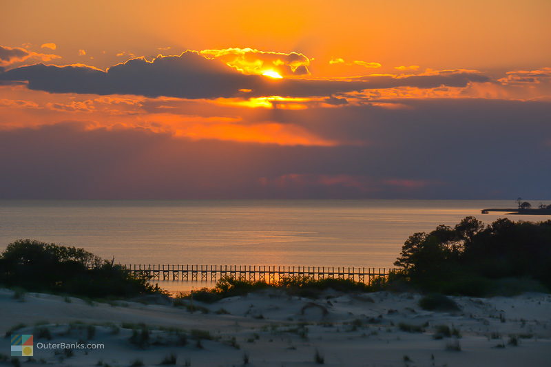
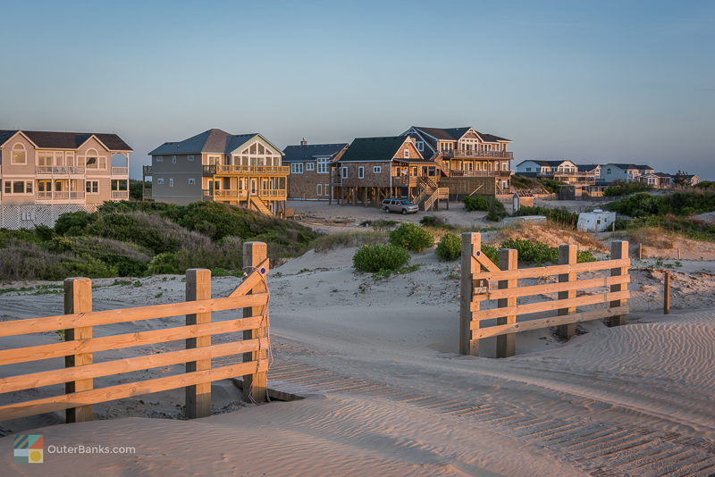
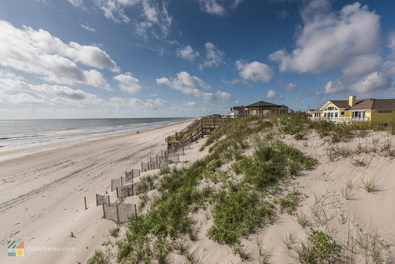
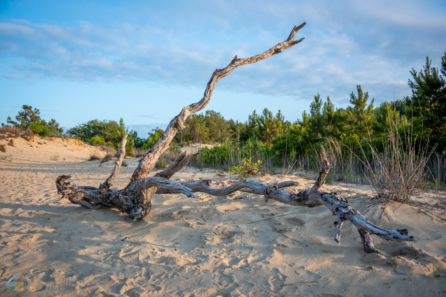
There's a reason why so many aspiring and professional photographers flock to the Outer Banks. ocean sunrises, sound sunsets, and miles of quiet wildlife in between create some breathtaking landscapes, ideal for photographers, painters, or plain-old vacationers who love an astounding view.
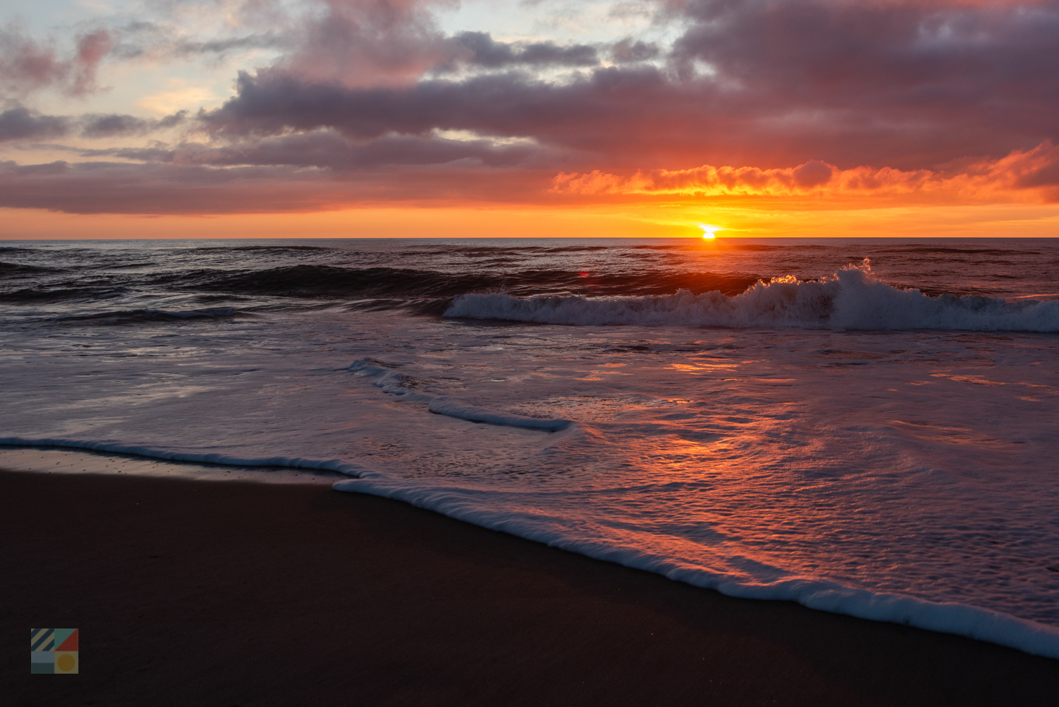
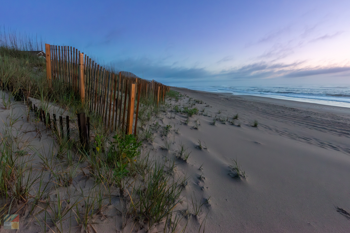
Any OBX beach is capable of producing the most amazing sunrise you'll ever see. Let's dig further and talk about some specific spots. Some of these scenic locales can be spotted from your passenger window while passing through, while others, like the very tops of the region's lighthouses, may take a little legwork to enjoy. Regardless of whether you seek out the Outer Banks' most scenic spots, or happen across them on a beach outing or an outdoor adventure, there's no doubt that even in the height of the summer season, there are plenty of gorgeous, private scenic locations to go around for all visitors.
By no means, do not consider the following list the only scenic locations to seek and scope out - every corner of the Outer Banks may offer a fantastic sunset, a gaggle of snow white geese, or a shell-lined morning beachscape. But if you're vacation revolves around killer photos and gorgeous views, any of the following locations are definitely worth a look.
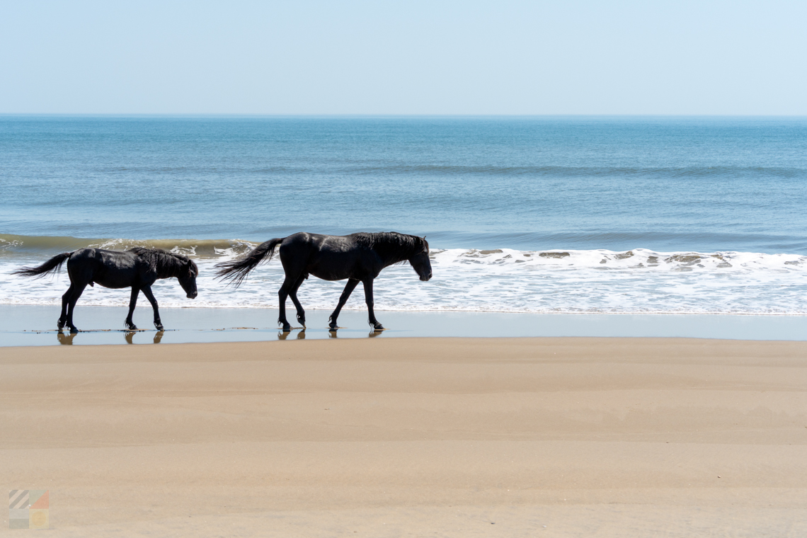
Carova
Carova Map It
When NC Highway 12 ends, a ramp to the beach begins which runs parallel to the ocean and accesses Carova. The 11 mile stretch of shoreline is virtually deserted, except for passing 4WD trucks, families enjoying the shoreline. Adventure here and you'll see the famous herd of wild horses, live oaks, pampas Grass and cedars. There are no grocery stores, shopping centers, gas stations, or commercial businesses of any kind in Carova - just small clusters of vacation homes, lots of beautiful nature and wildlife. Visitors should note that there are no paved roads in Carova, and a 4WD vehicle is necessary to reliably traverse the beach. Many tour companies offer daily guided tours to see the wild mustangs. Check our "Corolla Wild Horses" and "Driving on the beach" pages for more information.
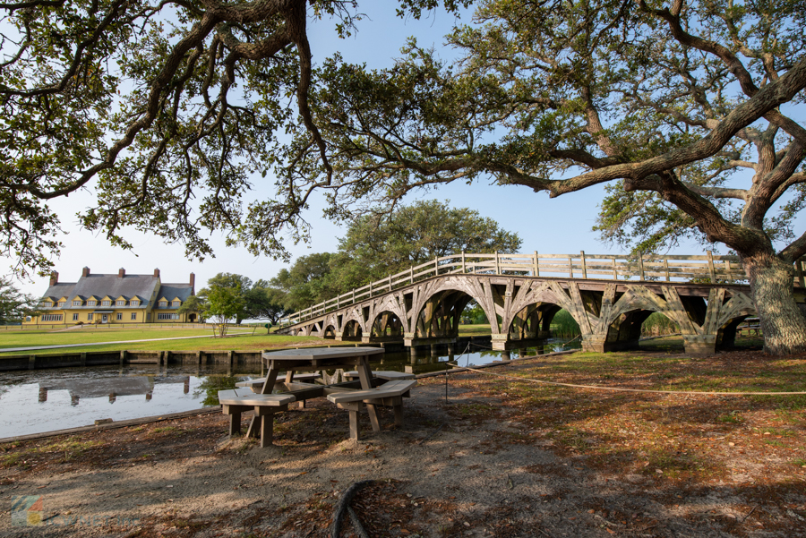
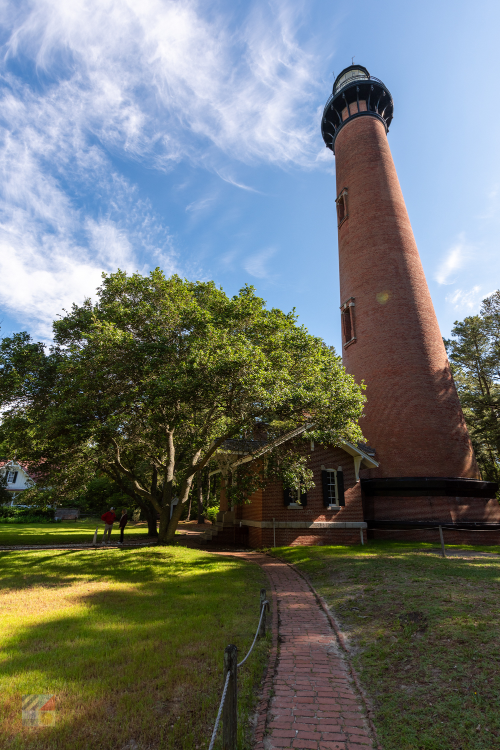
Historic Corolla Park
Corolla Map It
This family-friendly park is home to four great Outer Banks attractions. The Whalehead in Historic Corolla is one of Corolla's best attractions, offering seasonal guided tours, 39 acres of picturesque landscape for picnic baskets, and special facilities for weddings and special events. Currituck Beach Lighthouse is open to climbers seasonally to visitors from 9a.m. to 5p.m., and the wooded grounds, which include the original light keepers home, is idyllic for a bike ride or a stroll through the live oaks. The Outer Banks Center for Wildlife Education includes a wildlife program for all ages such as fishing, an 8,000 gallon fish tank with local species, and world-class decoys that are part of the culture and tell the story of the region's water fowling heritage. Our favorite time of day at Historic Corolla Park is sunset. People gather here each evening to watch the sun go down over Currituck Sound in a beautiful setting.
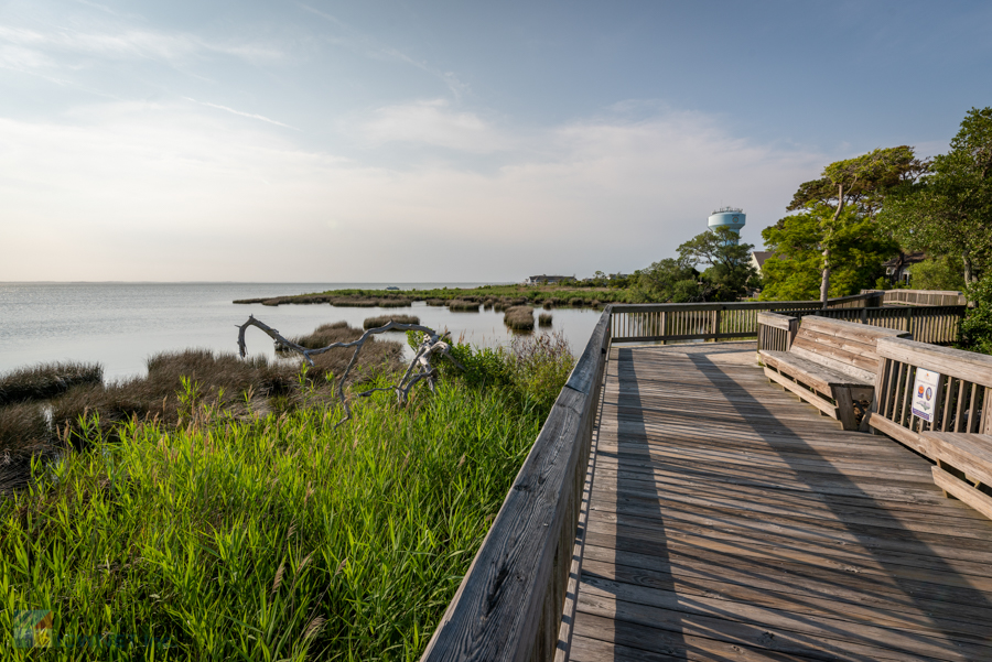
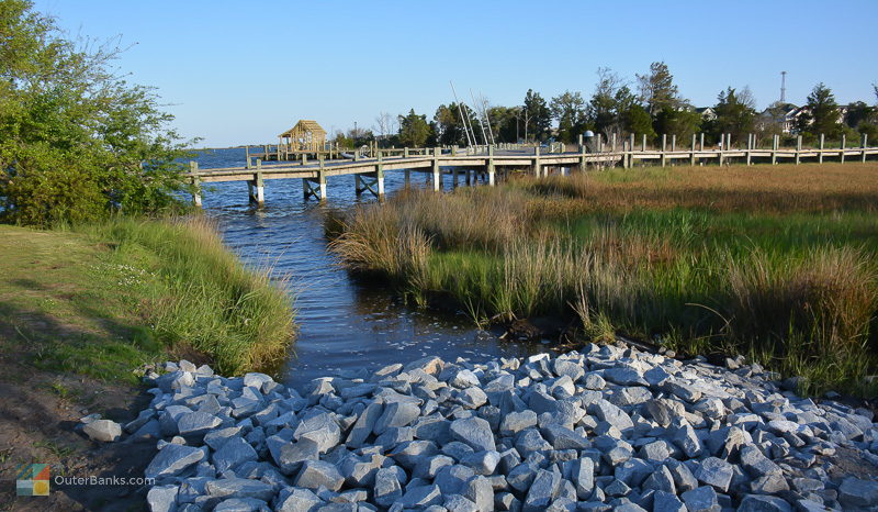
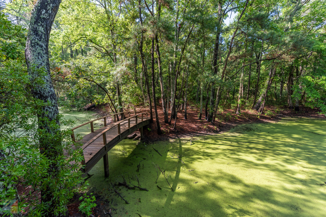
Duck Town Park
Duck Map It
Duck Town Park provides a playground for all seasons and more. Its 11 acres consist of a mix of Maritime Forest, willow swamp, open lawn with amphitheatre and picnic shelters, all sitting next to the lovely shallow waters of scenic Currituck Sound.
Situated in the heart of Duck, the Park is also central to most of the town's public activities. During the season, the smoke-free Park offers live theatre, stories and magic shows for children in the mornings and a concert series for all ages in the early evenings. All during the day, every day from dawn 'til dusk, visitors and locals can take advantage of the park's picnic shelter, walking trails through the woods, canoe and kayak access and playground with gazebo.
The latest addition to the Park is access to the town's new boardwalk, which is open from dawn until 1 a.m. and offers breathtaking soundside views, peaceful sunsets and a connection to solitude and nature, as well to the bustle of Duck's many visitors shopping and dining during the season. Duck Town Park provides two parking areas where visitors and locals can leave their cars and enjoy any or all Park activities, or they can choose to access the boardwalk and take in all it has to offer.
The Town of Duck sums up its Park as a place for family fun, sound side activities, natural beauty, awesome music and stunning sunsets.
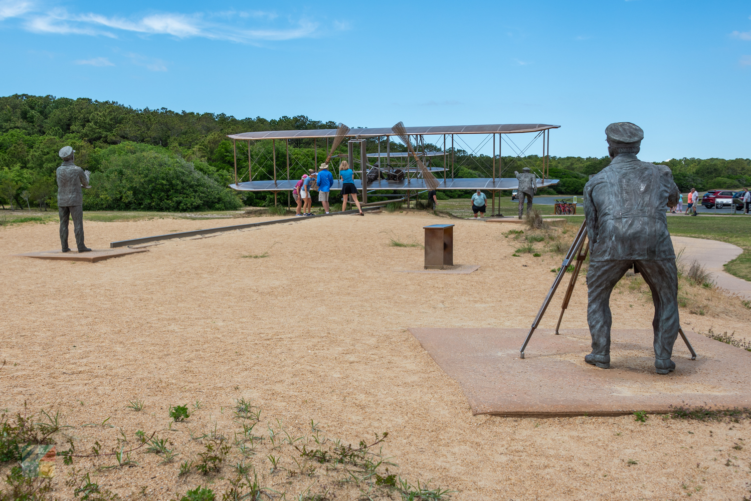
Wright Brothers National Memorial
Kill Devil Hills Map It
Another sky-high view is located nearby, at the Wright Brothers National Memorial in Kill Devil Hills. This granite monument, lit by a series of heavy duty flood lights, can be viewed at night from all across the Outer Banks, and in the day, can make a spectacular launching point for incredible island views.
Climb to the top of the tall grassy hill for an up-close view of the spectacular wind and weather conditions that drew the Ohio-based Wright Brothers to the Outer Banks to test their flying machines in the first place. From the top of the hill, and at the base of the monument, visitors can see the ocean, the Albemarle Sound, and the bustling summer towns of Nags head, Kill Devil Hills and Kitty Hawk.
Bring a camera, and be sure and reserve a little extra time to explore the Wright Brothers Memorial Museum on site, which is filled with over 100 years of aviation history.
Jockey's Ridge State Park
Nags Head Map It
There are other ways to experience a top-of-the-world Outer Banks view without hiking up the steps of a local lighthouse. However, visitors may find the towering sand dunes of Jockey's Ridge State Park just as challenging as a lighthouse climb.
The Jockey's Ridge State Park is a veritable playground of sand, water, and woods, and attracts watersports and nature lovers of all types. But arguably the star attractions of the park are the mountainous sand dunes, clearly visible from the US 158 Bypass, and located directly across from the Kitty Hawk Kites complex. While the dunes attract hang gliders and adventure seekers, everyone is welcome to make the climb to the top for views of the Albemarle Sound and Atlantic Ocean, as well as everything in between. Be sure and bring sturdy shoes if you make the trek, as well as a bit of sunscreen, as with nothing but sandy terrain all the way to the top, the climb can be trickier than it looks.
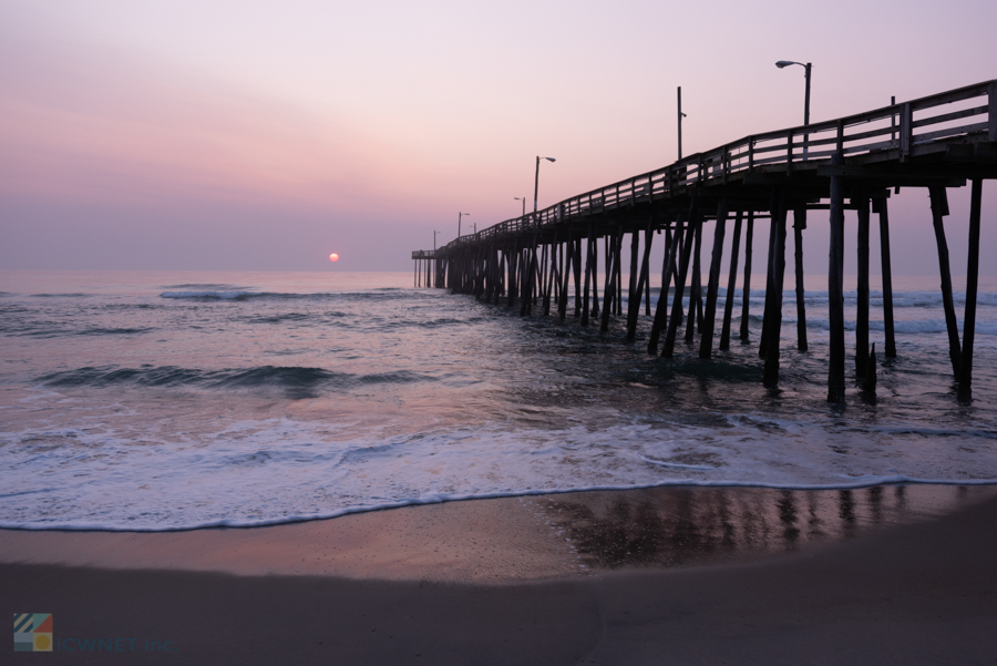
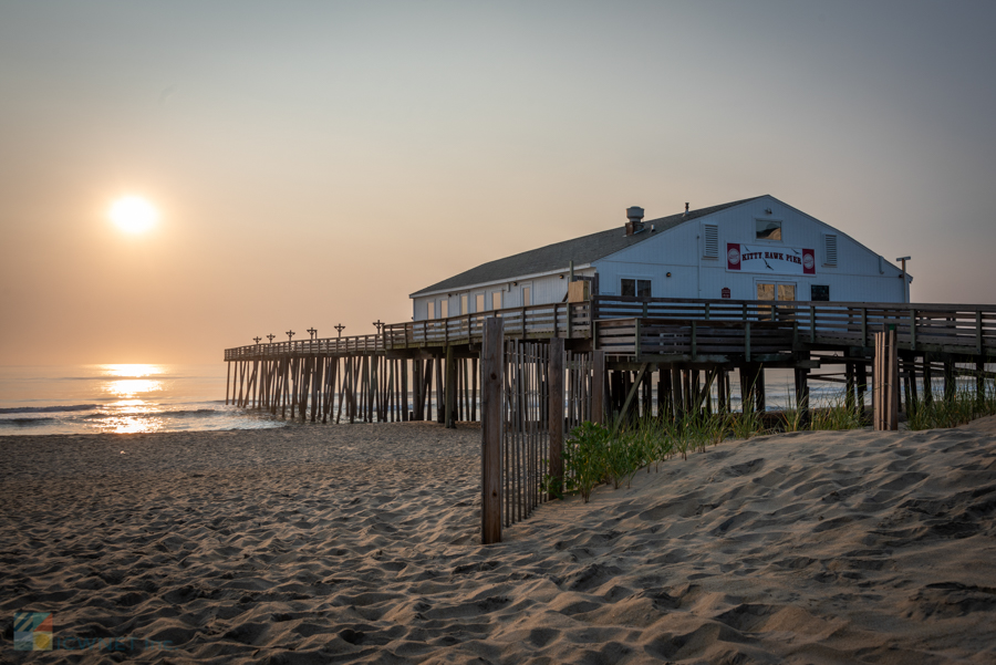
Jennette's Pier
Nags Head Map It
Jennette's Pier is one of the most popular fishing piers on the Outer Banks, attracting thousands of anglers from all around the country, in addition to families and curious vacationers who simply want to learn a little more about the extensive North Carolina Aquarium programs that are an essential part of the pier's daily operations.
Sightseers are just as frequent as fishermen on this concrete structure, and anyone out for an afternoon stroll will be captivated by the sight of accomplished anglers reeling in huge catches, the dark shadows of fish scurrying underneath the pier pilings, and the out-of-this-world views of the town of Nags Head itself. In fact, there's no better way to get a new perspective of the Outer Banks from the ocean's viewpoint than a long walk down an equally long pier, and visitors are advised to bring their cameras to capture some of the best shots of their vacation.
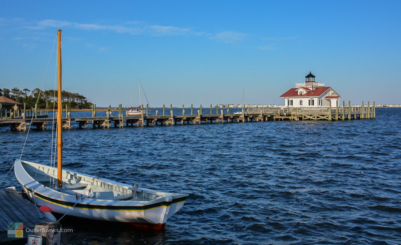
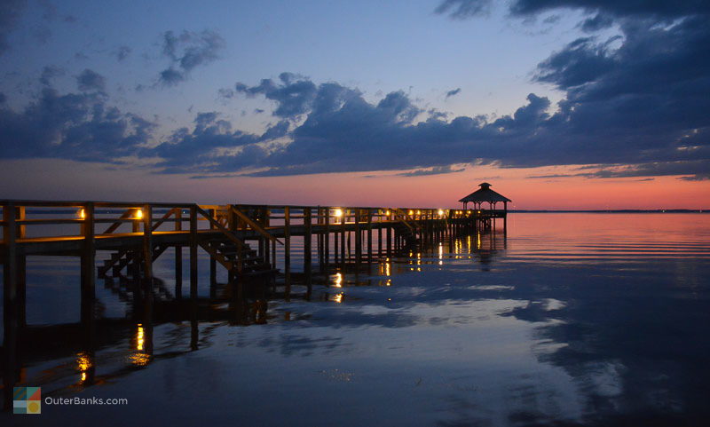
Roanoke Marshes lighthouse
Manteo Map It
The Roanoke Marshes lighthouse is often one of the most overlooked of the Outer Banks lighthouses, simply because of its small stature, limited visibility and remote location tucked away at the quiet east end of the Manteo waterfront.
That said, visitors to historic Downtown Manteo will have no problem spotting the small lighthouse that jets out 40 yards into the Roanoke Sound. The prim white exterior with black shutters and red shingled roof, capped off by a 2' ft., 4" in. tall lens, gives this lighthouse a classic coastal look, and vacationers of all seasons are welcome to stroll the wooden boardwalk and explore the exterior, while enjoying a fantastic waterfront view to boot.
Regardless of whether the interior of the lighthouse is open, visitors throughout the year are still welcome to walk down the long boardwalk over the Roanoke Sound to enjoy the perimeter decks, complete with benches for taking a load off and enjoying a fantastic soundfront view. If you go, don't forget to bring your camera. This lighthouse's location jetted out into the water on the outskirts of the busy waterfront provides some exceptional photo ops of downtown Manteo and the waterfront sunsets.
For the best access to the lighthouse, head to the eastern end of Downtown Manteo to the free public parking area abutting the bulk headed docks. From there, it's a hop, skip and a jump to the Outer Banks' newest, and most distinctive, coastal lighthouse.
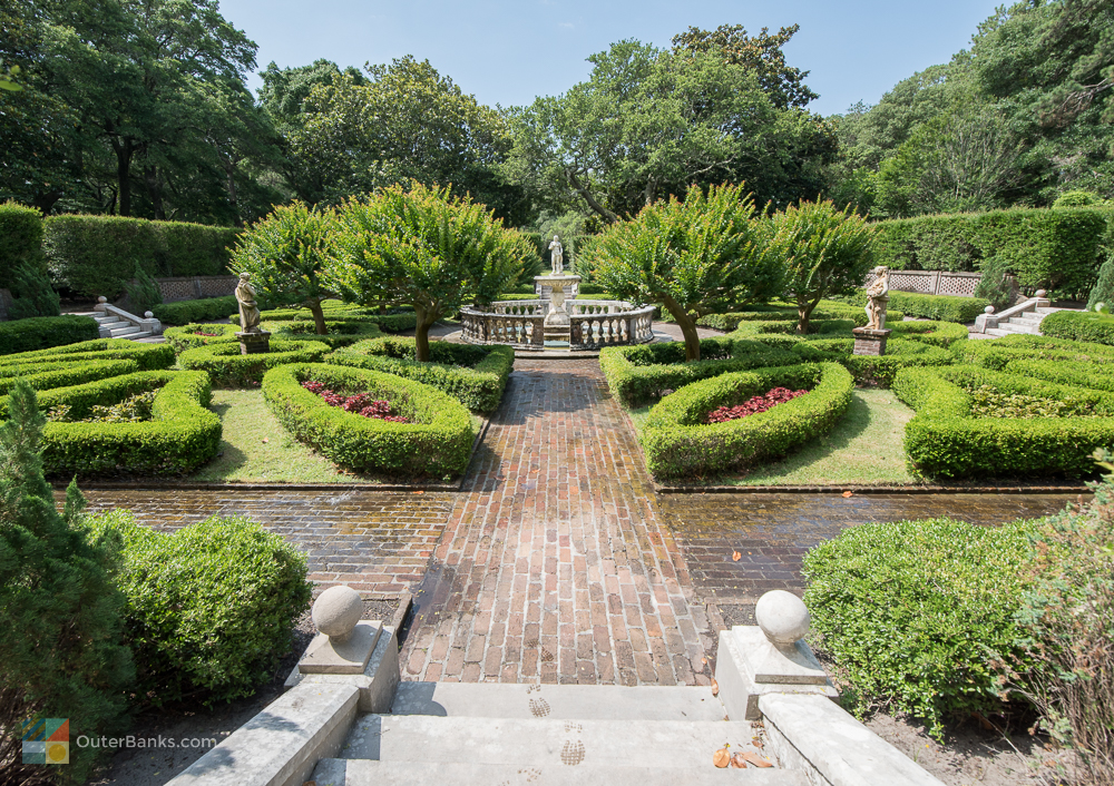
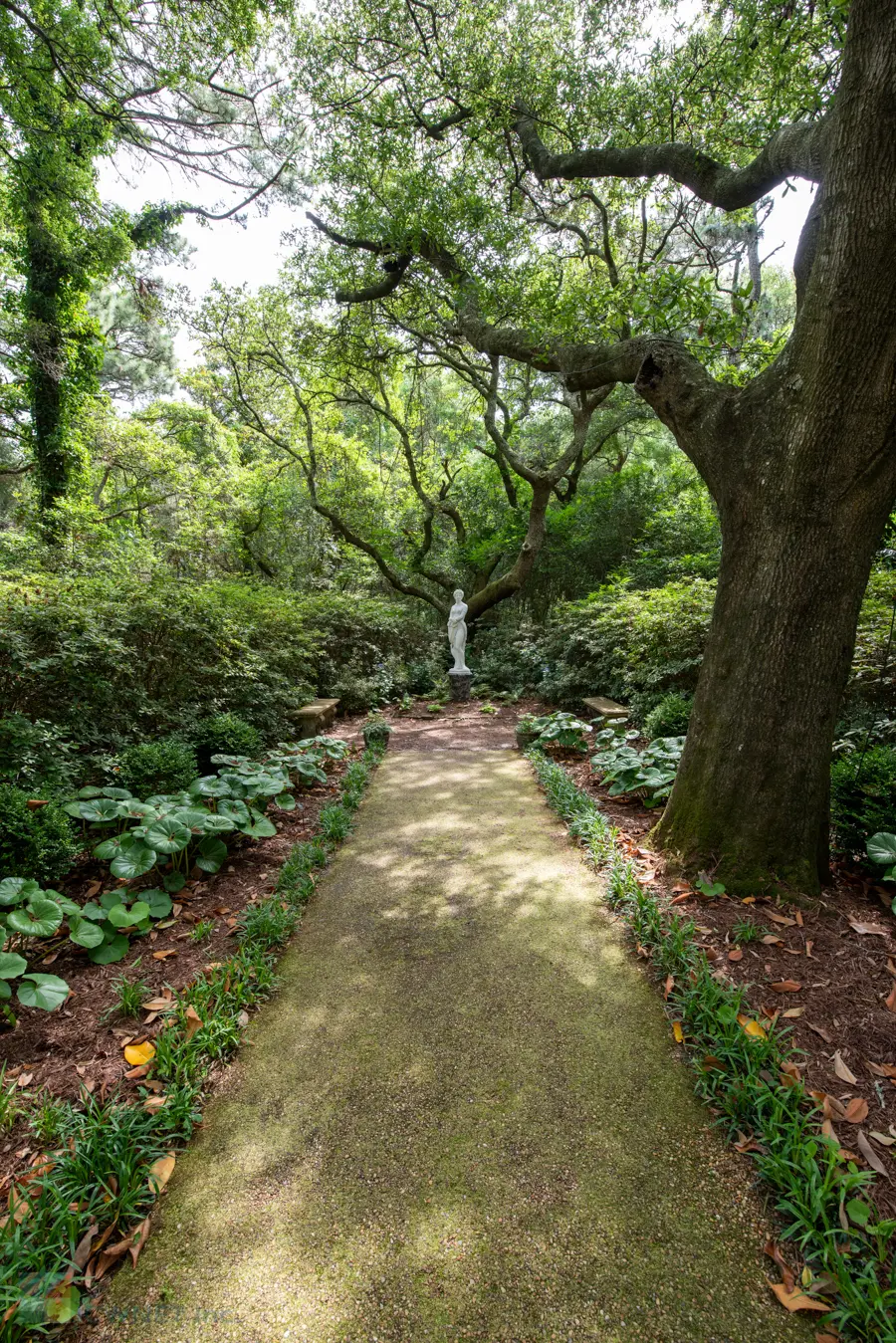
Elizabethan Gardens
Manteo Map It
Nature photographers will find acres of natural beauty to capture at the Elizabethan Gardens in Manteo. The acres of carefully tended and manicured landscape have different scenery for every season, with fresh daffodils and tulips in full bloom in the spring, and Magnolias and Camellias flowering the grounds well into the winter. Open seven days a week all year long, frequent visitors to the Outer Banks are encouraged to visit the gardens at different times throughout the year, as every week the Elizabethan Gardens sprouts in a new color and range of local foliage.
Photography and art classes are offered at the Elizabethan Gardens, allowing budding artists to expand their talent, and the diverse selection of Elizabethan roses, natural local plant species, and plenty of artwork and historical statues throughout gives visitors nothing but pristine Outer Banks scenery any time of year.
A fee is required to access the Elizabethan Gardens, and classes are available throughout the year with advance reservations. Late summer visitors should definitely make the Elizabethan Gardens a must-stop on their scenic Outer Banks list, as the acres of hydrangeas, from pale pink to deep royal blue, are an unparalleled but seasonal Outer Banks attraction.
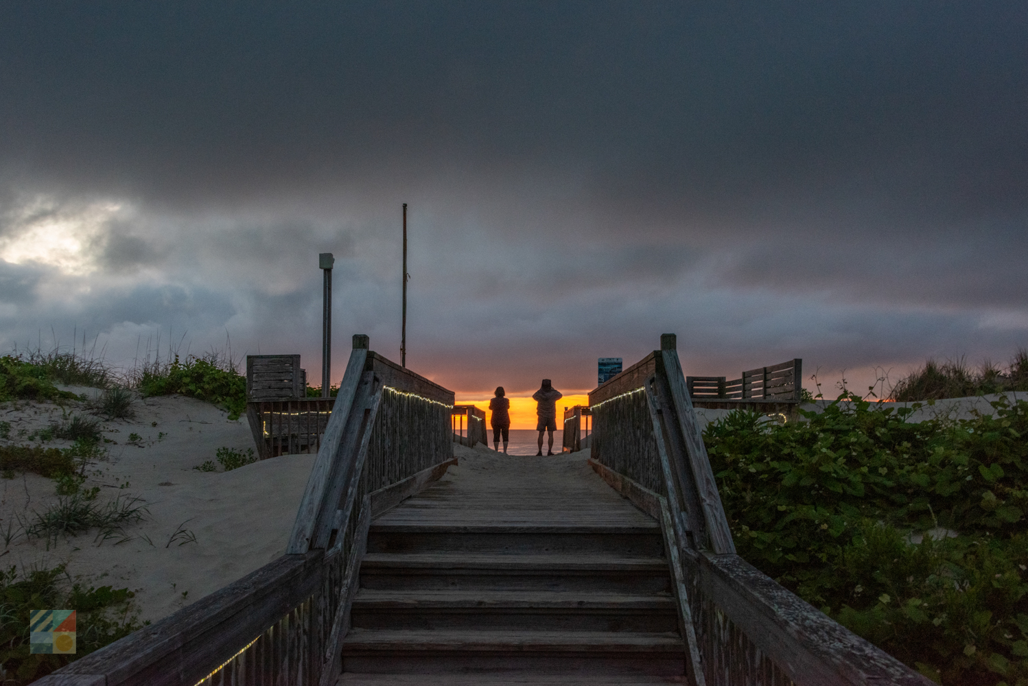
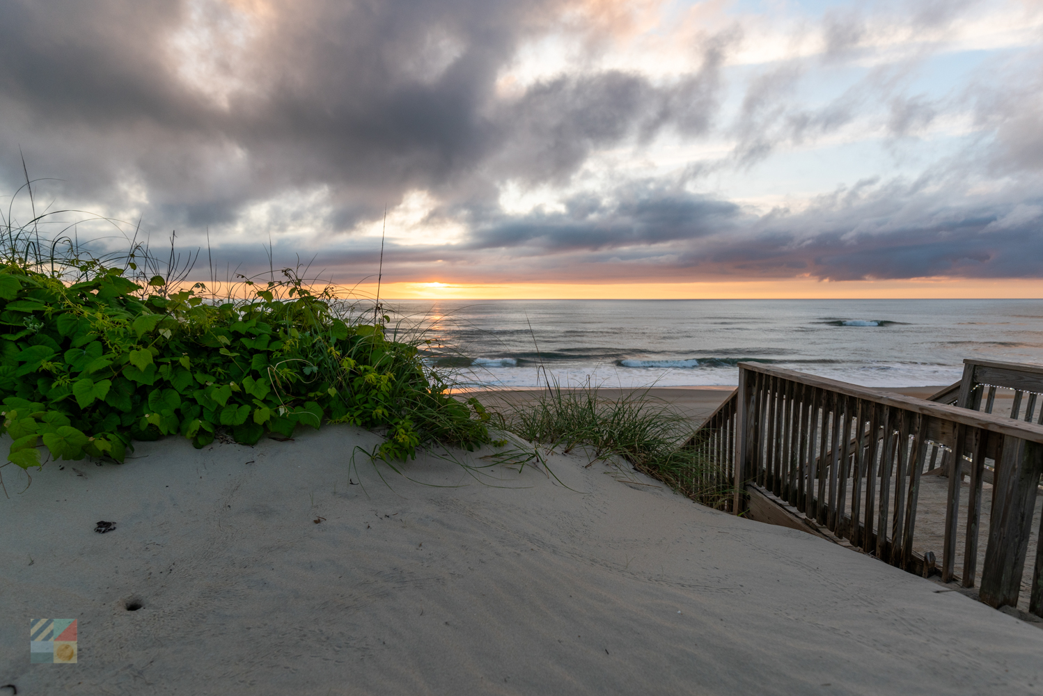
Outer Banks visitors who crave a beach vacation with a spectacular view will find plenty of secluded parks, ocean beaches, and soundfront boardwalks to explore. From sunrise to sundown, the Outer Banks landscape is filled with amazing photo ops and breathtaking reasons to pause and enjoy the sights.
Visitors have their choice of venturing to the top of the Outer Banks' "peaks," whether it's their local lighthouse or the towering natural sand dunes of Jockey's Ridge, or just take in the scenery at eye-level from an assortment of waterfront and quiet, private locales.
Venture out onto the road for a complete tour of the Outer Banks Scenic Byway, or just stick close to home and enjoy the views. The best thing about the Outer Banks is that any spot in any given time of day can present gorgeous, natural scenery. So be sure and bring a camera, because when you return home and try to share the beauty of the Outer Banks with your friends and family, you'll find that a picture is most definitely worth a thousand words.
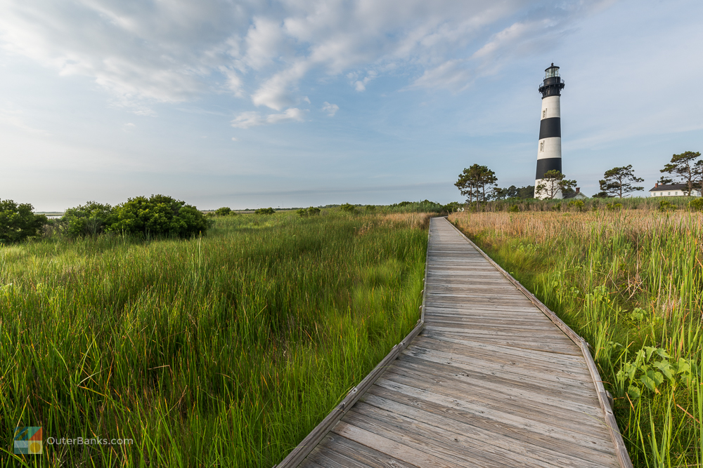
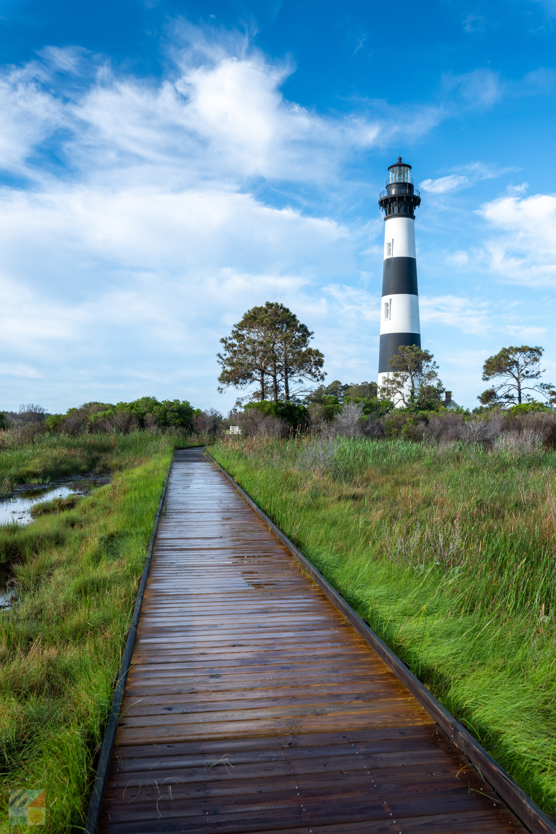
Bodie Island Lighthouse
Nags Head Map It
The Bodie Island Lighthouse, (pronounced "Body") is located just south of the town of Nags Head and Whalebone Junction, where Highway 158, Highway 64, and NC Highway 12 intersect. Visitors travelling towards Hatteras Island can't help but notice the black and white horizontal striped structure, peaking out over a line of dense cedar trees on the soundside.
Since completion of recent restorations, visitors are again able to access the interior of the lighthouse, and the lighthouse grounds are still open for exploring and photos. The original light keepers' home, remodeled in 1992, now serves as a ranger station and Outer Banks information center.
The grounds surrounding the Bodie Island Lighthouse, a mixture of marshlands, maritime forest and small saltwater ponds, are a popular destination for nature lovers and bird watchers. Its proximity to the Pea Island Wildlife Refuge, just across the Bonner Bridge, means that hundreds of species pass by the Bodie Island Lighthouse on a regular basis. On your next visit, be sure and bring your binoculars and your camera.
Oregon Inlet
Nags Head Map It
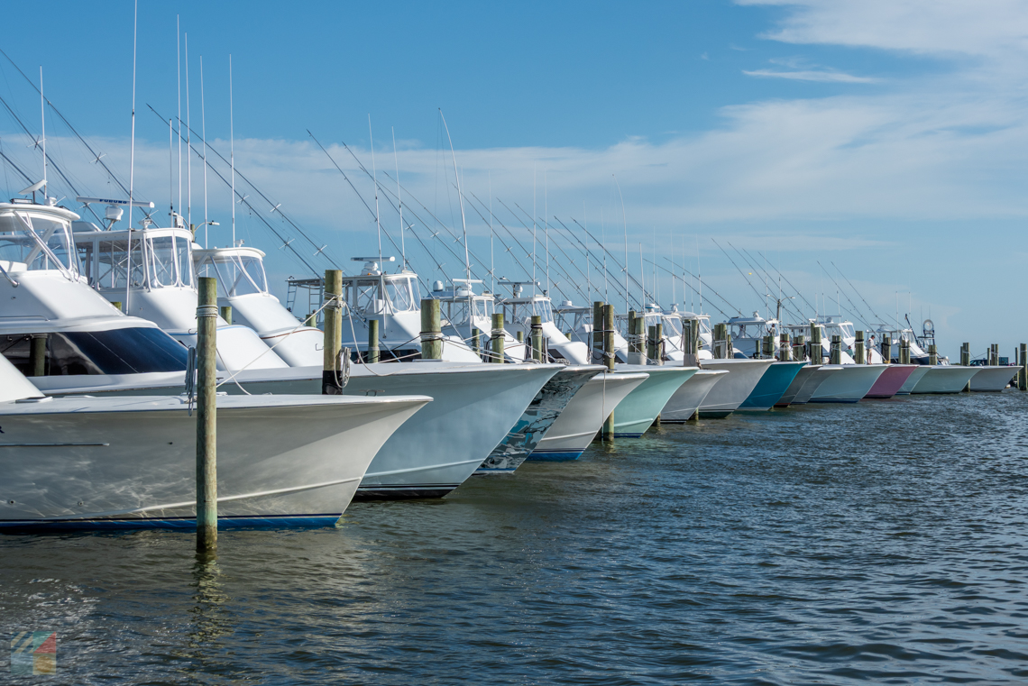
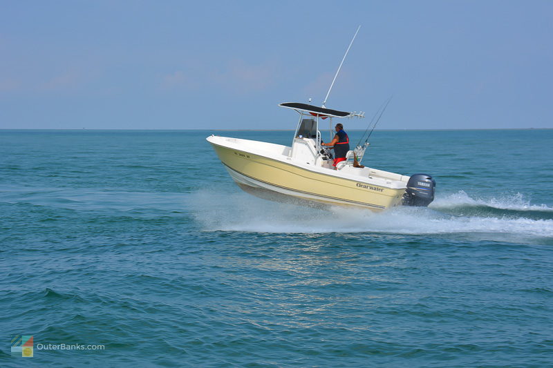
Always shifting and seemingly always a focal point of local history or controversy, Oregon Inlet is nonetheless a breathtaking area of open water that connects the Atlantic Ocean and the Pamlico Sound, providing an easy route for charter fishermen, commercial fishermen, and day trippers to get out and explore the waters. With lovely ocean or soundside beaches located on either side, and a historic US Coast Guard station, (formerly a Lifesaving station), perched at the edge of the inlet's shores, a visit to Oregon Inlet typically includes some enjoyable beach time, good fishing, and simply incredible views.
The Oregon Inlet Marina is also home to a number of local tour boats that take visitors out on scenic tours along the water. Whether vacationers embark on a wildlife tour, a dolphin tour, or simply a little sunset spin around the Pamlico Sound, Oregon Inlet provides an ideal gateway to a number of on-the-water tours and fishing adventures.
Pea Island National Wildlife Refuge
Rodanthe Map It
The 17 miles in between the Bonner Bridge and Rodanthe along the Outer Banks Scenic Byway are home to the Pea Island National Wildlife Refuge. This area of the Outer Banks is home to over 400 migratory species of birds, with no development except for a small visitors' center, and miles of soundfront and oceanfront views. Drivers will notice small wooden stands along the side of NC Highway 12 indicating scenic overlooks, as well as several parking areas by the refuge's most attractive or bird-heavy locales.
Nature lovers will adore exploring the scenic trails that cut through the center of the refuge, bordering salty marshes, small ponds, and eventually leading to the Pamlico Sound. View-lovers in a hurry can simply stop by one of the observation stands, like the one on the northern side of the Bonner Bridge that overlooks a sprawling saltwater marsh, to get their fill of unspoiled nature photography.
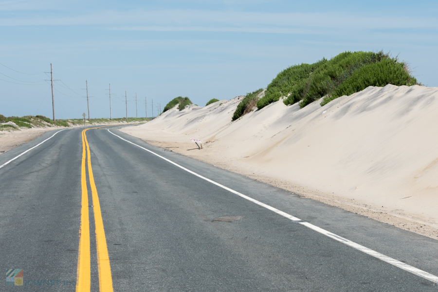
Outer Banks National Scenic Byway
As an indication of just how beautiful the Outer Banks are to visitors, the 138 mile stretch of coastline from Whalebone Junction just north of Nags Head to the southern beaches of Carteret County has been recognized as a National Scenic Byway. This designation recognizes parcels of national roads that are exceedingly scenic drives, and worthy of admiration, and the Outer Banks National Scenic Byway is certainly one of the most popular drives on the list.
From Nags Head, the route heads south through all of Hatteras and Ocracoke Islands. From there, it's a lazy ferry ride to Cedar Island and the desolate marshlands of Hyde and Carteret County, ending at the west side of North River and the intersection of US 70. The drive includes two ferries, the free Ocracoke / Hatteras ferry, and a toll ferry to Cedar Island. Though this byway can be explored in its entirety in a single day, travelers are encouraged to stop and smell the seashells, as there are plenty of accommodations dotted along the miles of oceanfront and soundfront highway.
If you tackle the byway, be sure and make your Cedar Island Ferry Reservations in advance, as in the summer months, spots can fill up fast. The ferry can accommodate around 50-75 vehicles and features a spacious indoor lounge with restrooms, vending machines, tables and chairs, and TVs. The ferry generally runs between 4-6 times a day, depending on the season, and reservations can be made online or by calling 1-800-BY-FERRY.
Haulover (Canadian Hole)
Avon Map It
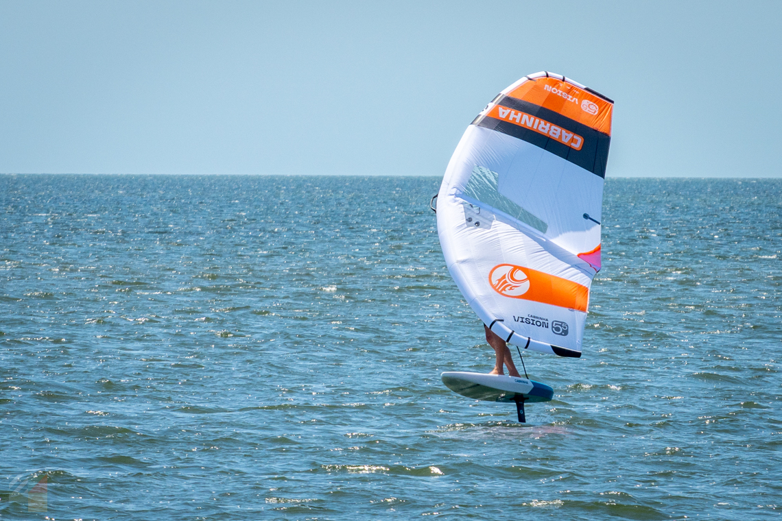
The Canadian Hole parking area, located in between Avon and Buxton on the Scenic Byway, is also a prime location for photo hounds for the sheer number of activities that can be happening on a regular basis. On a clear spring or fall day with a stiff breeze, the waters off the Canadian Hole can be crowded with dozens of kiteboarders, windsurfers, kayakers, and small fishing skiffs. In the background, the Cape Hatteras Lighthouse can be seen clearly, towering over the waterfront while the kites and windsurfers whoosh by. For a photo opt that combines all things Outer Banks - watersports, amazing views, and a historic lighthouse - there's no match for Canadian Hole.
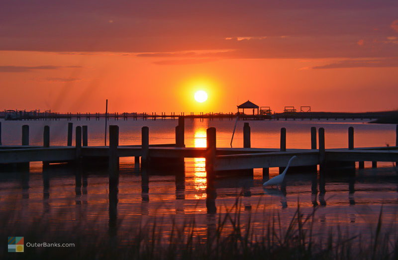
This location is also a fantastic spot for an amazing sound sunset. Featuring a wide sandy beach, all an onlooker has to do is spread out a towel or a beach chair, sit back, and enjoy the show. Best of all, in the off-season months of December, January and February, the occasional sunset lover can enjoy plenty of elbow room, and will often be the only person on the beach, taking in the view.
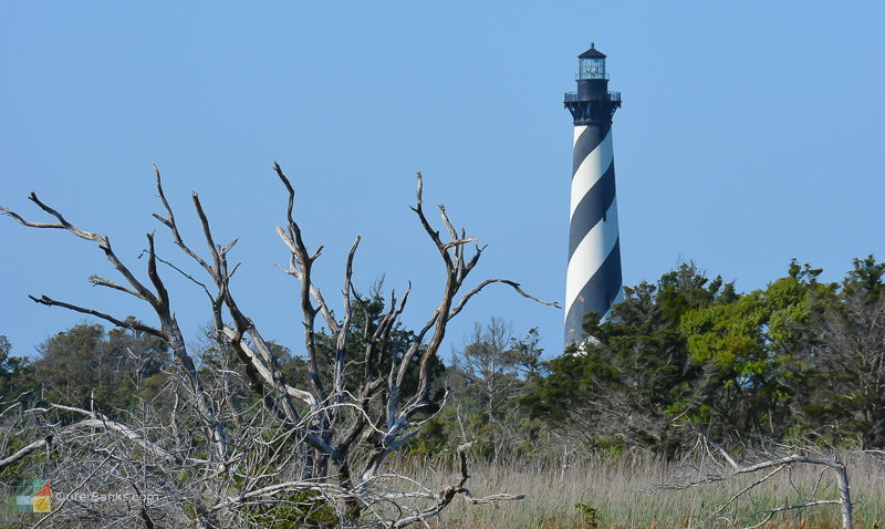
Cape Hatteras Lighthouse
Buxton   252-473-2111    Map It
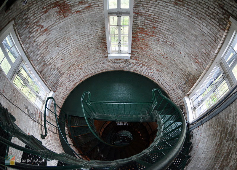
The Cape Hatteras Lighthouse, with its black and white candy-cane stripes, is one of the most famous and recognizable lighthouses in the world. Protecting one of the most treacherous stretches of the Outer Banks, with a beam of light that spans 20 miles into the ocean, the lighthouse is also the world's tallest brick lighthouse at a staggering 208' ft. tall.
Considered one of Hatteras Island's biggest attractions, over 175,000 visitors come to the Cape Hatteras Lighthouse every year to climb the 257 steps to the top. But don't let those large numbers of tourists scare you - Hatteras Island, and subsequently the Cape Hatteras Lighthouse, is known for being unpopulated and uncrowded, even in the height of summer, making it a very attractive destination for Outer Banks vacationers.
The grounds around the Cape Hatteras Lighthouse, including the two keepers' quarters buildings, are home to a lighthouse museum and gift shop filled with books, toys, and lighthouse souvenirs. There is also a shaded picnic area nearby, a .75 mile nature trail, and the beach ramp access to Cape Point.

Cape Point
Buxton Map It
For beachcombers, the stretch of coastline just south of Cape Point, called "South Beach," is one of the best shelling locations on Hatteras Island. Here, beachcombers can find unusual varieties that rarely make appearances north of South Carolina, such as the Florida Fighting Conch, Helmet Conchs, and even spiny murexes. In addition, a number of local North Carolina treasures wash up on a regular basis, including whelks, olive shells, sand dollars, and the Scotch Bonnet, North Carolina's elusive and prized state shell.
The best time to go shell hunting is in the early morning hours, before too many people arrive, as South Beach's status as one of the best shelling holes on the beach is one of the island's worst kept secrets. Beachcombers also have fantastic luck right after a storm, when the rough ocean waves have subsided, and the beach is covered in shells.
In addition to shells, off-season visitors may spot pods of dolphin in the winter months, as these energetic sea critters flock to this area by the dozens if not hundreds. Playing remarkably close to shore, visitors can often spot dolphins and porpoises in droves splashing just yards away from Cape Point all the way to Frisco. The best time to spot them is from November to March, when the beach population dwindles, and the wildlife can rule the shoreline.
As for an attraction that everyone can enjoy, Cape Point and South Beach have a remarkable feature that's hard to find anywhere else on the Outer Banks - an oceanfront sunset. Only available at certain times of year, (again, usually from the late fall until the early spring), the geography of this section of shoreline combined with the location of the sun creates the illusion of the sun setting over the Atlantic waves. A truly spectacular sight, a winter Cape Point visitor should definitely bring a camera along, to catch an East Coast oceanfront sunset that, on the surface, seems simply unbelievable.
Hatteras Inlet
Hatteras Map It
A local Outer Banks inlet is a surefire gateway to a fantastic view, and the Hatteras Inlet is certainly no exception. There are a variety of ways to enjoy this expanse of mingling ocean and sound waters, with a handful of small sandy islands in the main channel that come and go with the tides.
Many visitors find the best views are from the open water, and the free ferry in between Ocracoke and Hatteras, which is also a pivotal point of the Scenic Byway, provides the perfect vantage point for photos. The 40-minute ride drifts past the northern end of Hatteras Island to the southern border, and gives passengers perfect views of the tips of both islands, as well as the small islands in between, and countless shorebirds that frequent the waters.
Another way to hunt down the scenic views is to explore the 4WD accessible sandy trails that veer through the northern end of Hatteras Village, and the southern tip of Ocracoke Island. Both sides of the inlet offer 4WD-only accessible paths that lead to isolated soundfront locales, wide oceanfront beaches, and even access in the off-season to the very edges of the inlet itself. Drivers will need to obtain a 4WD Beach Driving Access Permit, which can be purchased on a weekly or annually basis at a number of National Park Stations throughout the National Seashore.
Finally, pedestrians who want to take the beaches in stride can simply go for a walk. Both sides of the inlet have public parking areas and sandy beach paths that lead out to the outskirts of their respective islands, and feature amazing ocean or soundfront views. Hatteras Island strollers should note that the walk can be a long one, with an estimate 3 miles from the village's northernmost parking area to the end of Hatteras Island, so bring along a bottle of water and plenty of stamina.
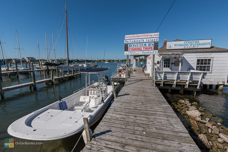
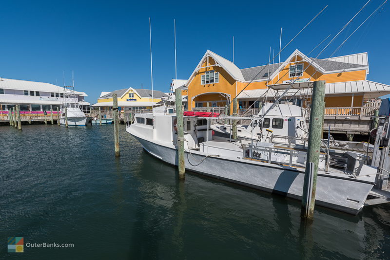
Ocracoke Harbor
Ocracoke Map It
There's a good reason why so many homegrown rustic restaurants have set up roots on Ocracoke Harbor, one of the last stops along the Scenic Byway before boarding the Cedar Island ferry. The views from the circle-shaped waterfront are simply superb. Here, visitors will find a world of maritime activity, seemingly trapped in time among old harbor houses, small residential cottages, and makeshift restaurants and bars. The harbor front spans a good mile or so, although the action is in the center, where this busy portion of NC Highway 12 is populated with pedestrian traffic looking for quirky shops, art galleries, small boutique hotels, and fresh seafood fare.
Because of the high foot traffic, this area is best explored on foot or on bicycle, and visitors are encouraged to find a harbor front bench, or a picnic table at one of the local restaurants for fresh fish and cold drinks, and take in the scene. Be prepared for a harbor full of dour pelicans, small charter boats, gliding sailboats, and large ferries leaving to and from port on a regular basis.
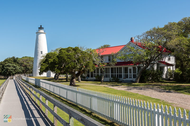
Ocracoke Island Lighthouse
Ocracoke Map It
The Ocracoke Island Lighthouse may not be the most imposing of the Outer Banks lighthouses, but as North Carolina's oldest lighthouse in operation, (and the second oldest in the United States), it is certainly one of the most beloved. At just 65' ft. tall, it is by far the smallest lighthouse on the Outer Banks, but it still towers over the 4 square miles of Ocracoke Village, and its beacon can be spotted up to 14 miles into the Pamlico Sound and the Atlantic Ocean.
Visitors to Ocracoke Island make the lighthouse a must-see stop on their walking and biking tours throughout the village. Because everything is so close, finding and visiting the Ocracoke Lighthouse is a breeze once you're on island. In fact, an Ocracoke day trip and walking tour is typically a must on seasoned vacationers' to-do lists, as the entire excursion, from the fun 40-minute ferry ride across Hatteras Inlet to the multitude of quaint yet quirky shops and restaurants to explore once you've arrived, is pure Outer Banks entertainment for the entire family.
Outer Banks Scenic Photos


-
Avon Farmers Market
August 4th, 2026 9:00 AM - 1:00 PM -
Lighthouse 5K Series
August 4th, 2026 8:00 AM - 9:00 AM -
Corolla Cork & Craft
August 5th, 2026 12:00 PM - 7:00 PM

The Currituck Beach Lighthouse, located in the heart of Corolla, borders the historic Whalehead in Historic Corolla and still functions as a guide for passing mariners. At 162' feet tall, the lighthouse's First Order Fresnel light, (the largest size...

The Cape Hatteras Lighthouse, with its black and white candy-cane stripes, is one of the most famous and recognizable lighthouses in the world. Protecting one of the most treacherous stretches of the Outer Banks, with a beam of light that spans 20...
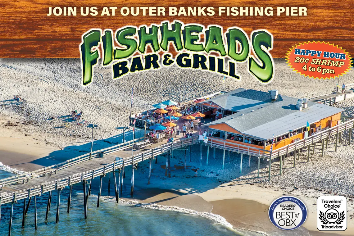
Rustic waterfront pub at a fishing pier with a large deck for seafood eats, draft beer & live music. Fish Heads Bar and Grill is THE tiki bar of the Outer Banks. Located at Mile Post 18.5 in Nags Head, we offer a view that is second to none...
Head south over the Marc Basnight bridge, or take the Hatteras / Ocracoke ferry from Ocracoke Island, and you'll land on the shores of Hatteras Island.

The Bodie Island Lighthouse, (pronounced "Body") is located just south of the town of Nags Head and Whalebone Junction, where Highway 158, Highway 64, and NC Highway 12 intersect. Visitors travelling towards Hatteras Island can't help but notice the...
Visitors to Hatteras and Ocracoke Islands will simultaneously be visiting the gorgeous Cape Hatteras National Seashore. One of the largest preserved parcels of the Outer Banks, the National Seashore stretches across 70 miles of shoreline...
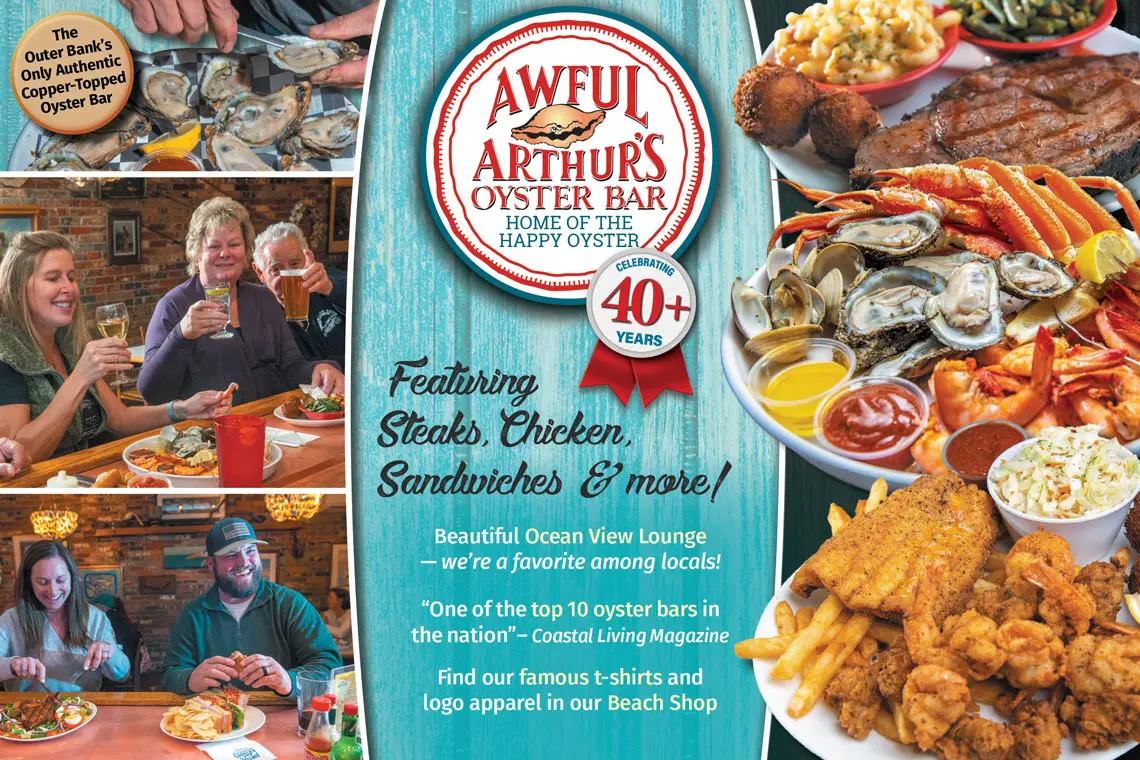
Welcome to the home of the happy oyster where for over 40 years the oyster has been our world. The Outer Banks only authentic oyster bar is the place to enjoy sensational fare from the sea washed down with your favorite brew or cocktail. We serve by...
Located just South of Salvo proper, the Salvo Day Use Area provides a peaceful haven for families, beachgoers, and watersports lovers. This park offers the perfect backdrop for taking in the Outer Banks' rich history and natural beauty. Everyone may...
Opened in 2021, the Bonner Pier is one of the more unique piers along the Outer Banks, as the 1,000-ft. long concrete structure was once the southern terminal of the original Bonner Bridge. Once the bridge was replaced by the new Basnight Bridge, a...
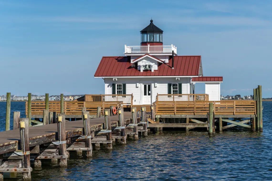
The Roanoke Marshes lighthouse is often one of the most overlooked of the Outer Banks lighthouses, simply because of its small stature, limited visibility and remote location tucked away at the quiet east end of the Manteo waterfront.
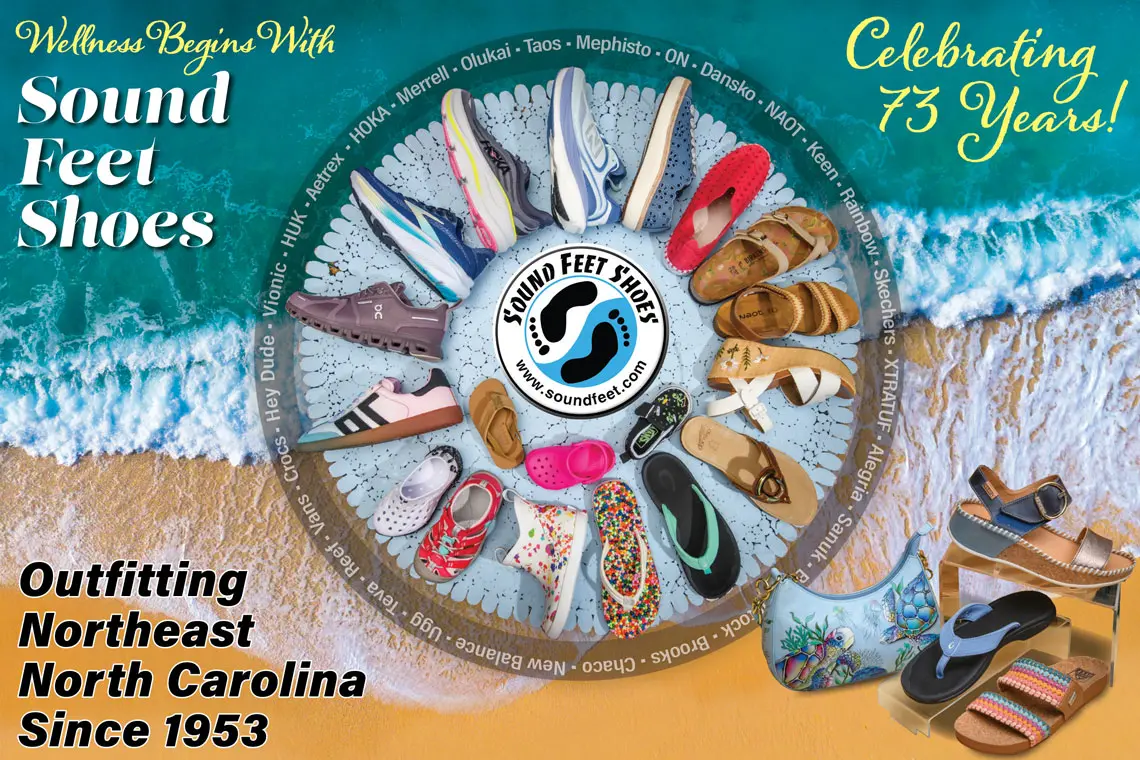
Sound Feet Shoes is family owned and operated. Sound Feet has been in the retail shoe business for over 72 years, opening their first store in 1953. They provide the best customer service and are the only Outer Banks’ area full service shoe...

Corolla, North Carolina is a must see nautical village scented with the spray of the salty sea. It's located on NC Highway 12 along a thin strip of land bordered on the east by the tempestuous Atlantic Ocean, and on the west by the inland waterway...

Discover Historic Corolla Park With its wide open green spaces and scenic views, Historic Corolla Park is the heart of Corolla in Northeastern North Carolina. It's a great place to take in a seasonal event or simply take a walk, and is home to three...

The Southern Outer Banks, particularly Ocracoke Island, is notorious as the stomping grounds for some of history's most infamous pirates. Notable swashbucklers from Calico Jack to Anne Bonney and Mary Reed, arguably the most famous women pirates...