Bodie Island tends to cause a lot of confusion, for both the pronunciation of its name as well as its precise location. This small strip of the Outer Banks doesn't get a lot of attention, and most North Carolina visitors simply pass through the area on their way to or from the Hatteras and Ocracoke Island resort towns, or make a quick stop for an up-close-and-personal view of the Bodie Island Lighthouse.
Upon closer examination, however, Bodie Island actually has a lot of offer, including incredible beaches and a 4WD beach access ramp, a Visitors Center, miles of migrating wildlife, and easy access to some of the best Gulf Stream fishing on the Outer Banks.
Next time you're passing through or on a mission to tour all four lighthouses on the Outer Banks, consider a longer stop at Bodie Island, and discover this unsung but completely charming section of the Outer Banks.
The History of Bodie Island
The first misconception most folks have with Bodie Island is the exact pronunciation of its name. Many visitors and even longtime locals pronounce the word "Bodie" with a long Southern "O," as in "BOW - die." The correct way to pronounce it, however, is like the word "Body," but if you get a bit confused, don't worry - the name has been mispronounced for so many decades now that many locals and longtime visitors are still not entirely clear on which version is correct.
The other misunderstanding that Bodie Island creates is the concept that it is an "island," as this hasn't been the case for over 150 years.

At one point, the central and northern Outer Banks had a handful of inlets which separated the concentrated communities from each other, and made Bodie Island an actual "island," completely separated from the northern beaches. However, as storms passed through over the centuries and new inlets were cut just south of Bodie Island and Hatteras Village, the original inlets closed up, creating one long barrier island instead of small island pearls winding down the North Carolina coastline.
As a result, the area commonly known as Bodie Island is simply a peninsula, located just south of Hatteras Island, and ending at the Northern border of Oregon Inlet. The exact length of Bodie Island also causes a bit of dispute, with some experts claiming that due to the closed inlets, Bodie Island technically extends all the way to the Virginia border, as there is no body of water to segregate it from other areas of the Outer Banks.
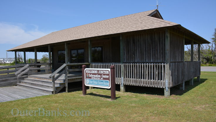
In most locals' and long-time visitors' minds, however, Bodie Island has exact borders which begin at the Whalebone Junction, (the term used for the intersection of NC Highway 12, US 64, and US 158), and end at Oregon Inlet. This geography is the most accepted parameters of Bodie Island, and though it might cause a little confusion to newcomers, the partnership of confusion and Bodie Island is certainly nothing new, and it's soon accepted with a laid-back shrug.
Visiting Bodie Island
As stated, most folks will simply pass through Bodie Island and never quite realized they have been there. After turning onto NC Highway 12, Bodie Island extends all the way to the Herbert C. Bonner Bridge, approximately 10 miles to the south. In between are virtually empty stretches of beaches, marshes, and wooded soundside maritime forest, but pay attention and you just might be surprised at everything Bodie Island has to offer.
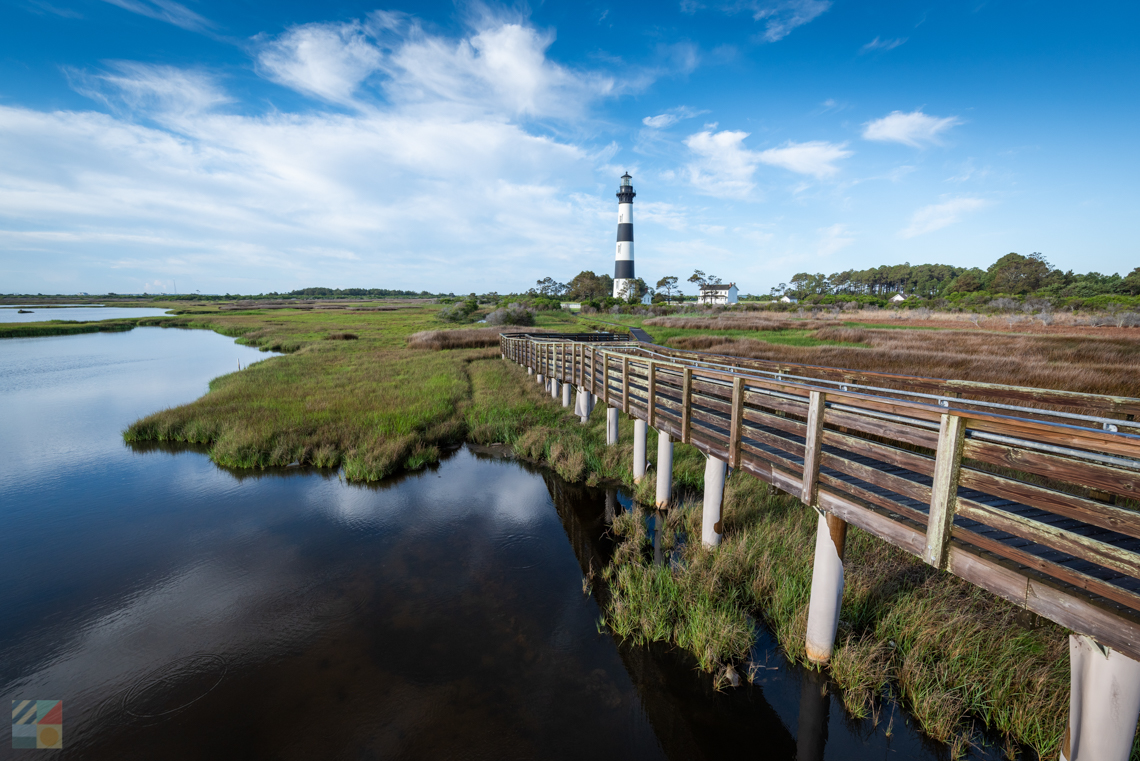
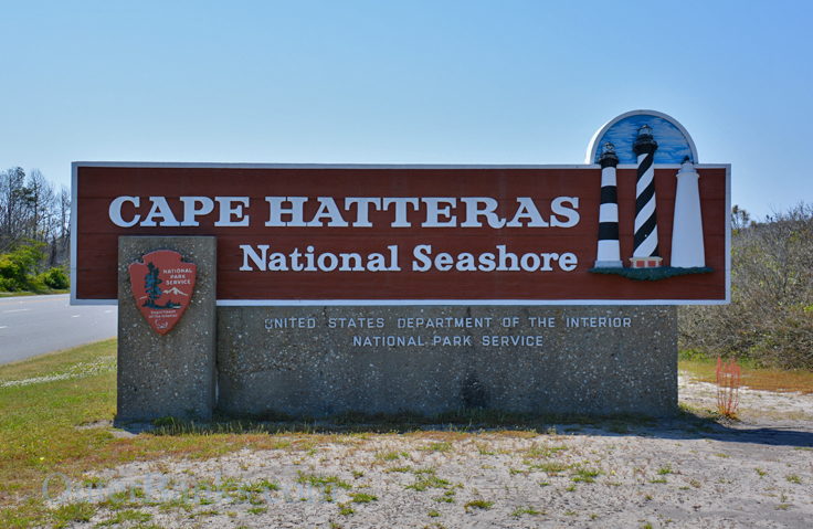
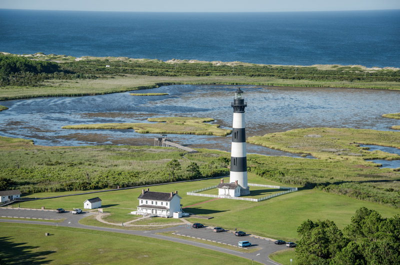
The Bodie Island Lighthouse is certainly the most visible landmark, and the black and white striped structure towers over the landscape. Constructed in 1872 and in operation ever since, the lighthouse has been almost recognizable to Outer Banks visitors in recent years, as the tall conical structure was covered with fencing, tarps, and giant canvasing as it underwent an extensive restoration to make it more accessible to vacationers. The project began in 2009 with the intent of reinforcing the circular stairs to the top, repairing or replacing the corroded metal decks, repairing bricks and stone throughout the structure, and adding or replacing electrical interior lights.
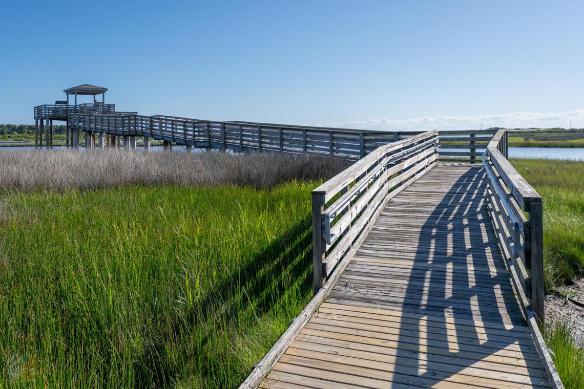
Because of these extensive efforts, the lighthouse is expected to have a "grand reopening" in 2013 and actually be able to be climbed by visitors for a small fee, similar to the Currituck or Cape Hatteras Lighthouse. In the meantime, however, visitors can still pop by the site for the Visitors Center with extensive local area information, as well as a series of scenic nature trails that run around the perimeter of the lighthouse grounds, or extend all the way to the waterfront with wooden boardwalks and incredible wildlife vistas along the way.
Wildlife lovers don't have to trek down the mile long nature trails by the Bodie Island Lighthouse to explore the area, however. Observant motorists will notice several wooden "stands" set out along the side of NC Highway 12 on this stretch, particularly in marshy areas that border the sound.
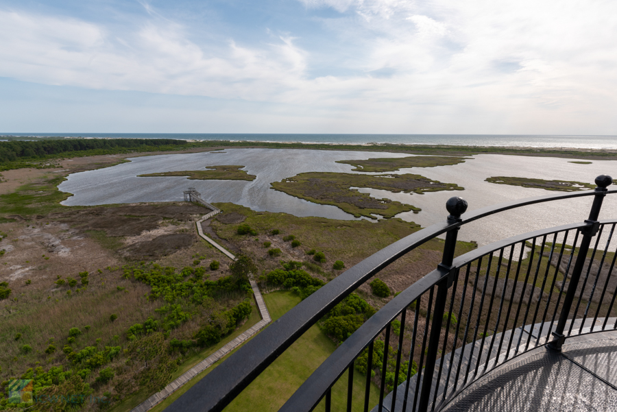
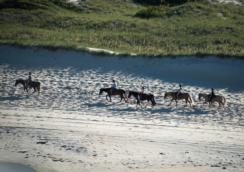
These stands were constructed and implemented with bird watchers in mind, as the soundside stretches of Bodie Island, (literally located just across the inlet from the renowned Pea Island Wildlife Refuge), are home to well over 400 species of birds that flock to the area en route to the North or South, depending on the season. From this vantage point, birders can expect to see a number of both shore and migratory birds including Canadian geese, egrets, snowy white ibises, great blue herons, and even graceful white swans. Birders who love an exceptional lookout but don't necessarily want to travel a great length to get there would be well served to spot these area bird stands, pull over, and have a nice long look.
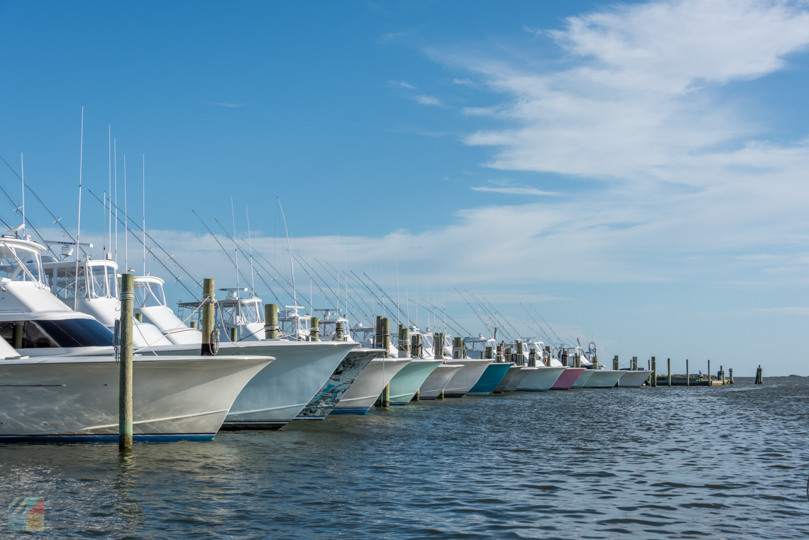
The other major attraction of Bodie Island is Oregon Inlet and the Oregon Inlet Fishing Center. Located next to the Basnight Bridge's northern entrance, this marina is a popular spot for charter businesses as well as small commercial fishermen, local tour boats, and private owners. Because of this, it's not unusual to see dozens of boats docked at the marina's innumerable boat slips every morning. Passer-bys who are headed south to Hatteras Island are welcome to pop in and take a look around, both at the variety of boats, and in the local ship's store which has drinks, snacks, and souvenirs for sale, as well as local fishing experts who are happy to answer questions.
In addition, if a charter fishing trip to the Gulf Stream is on your agenda, and you're vacationing in the central Outer Banks towns of Nags Head, Kill Devil Hills, Kitty Hawk or even Southern Shores, chances are your boat will launch from the Oregon Inlet Fishing Center. This marina has one of the largest concentrations of privately owned charter boat businesses on the Outer Banks, despite its remote location, as it's an easy run from the docks of the marina to the Oregon Inlet, and subsequently the Gulf Stream.
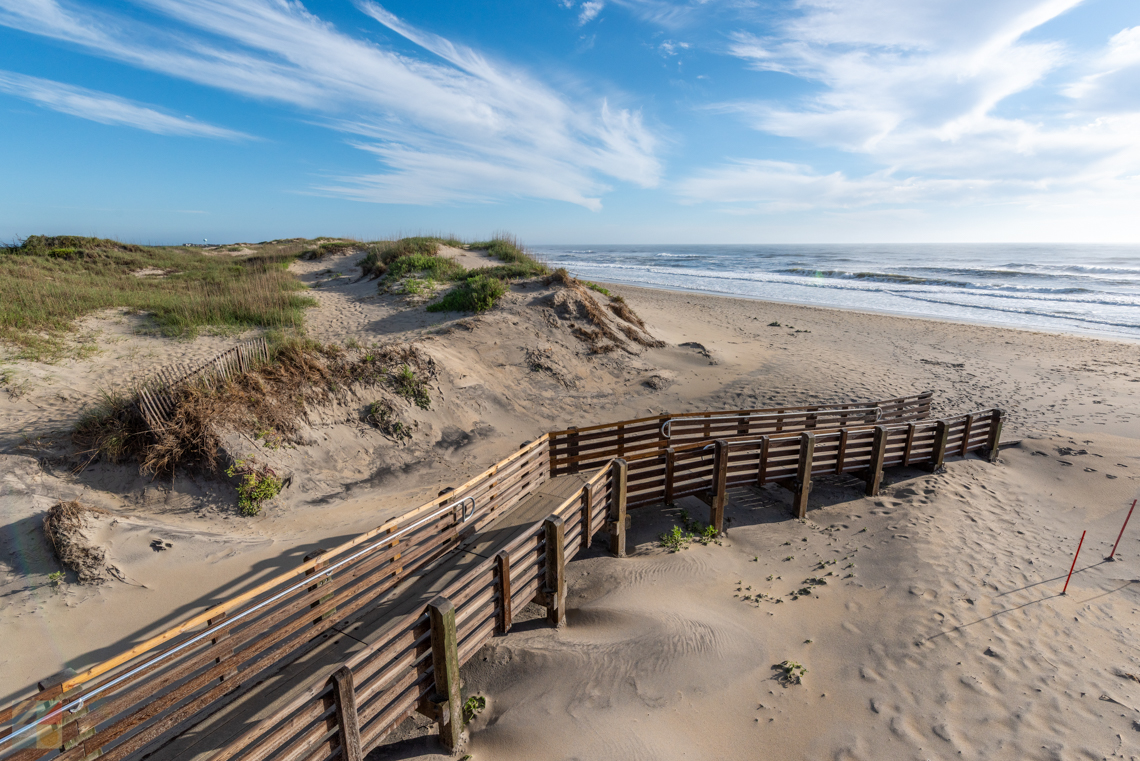
Bodie Island is also home to one of the Outer Banks' favorite secluded fishing beaches, and the first 4WD access ramp that's located along the Cape Hatteras National Seashore, Ramp 4, also known as "Coquina Beach."
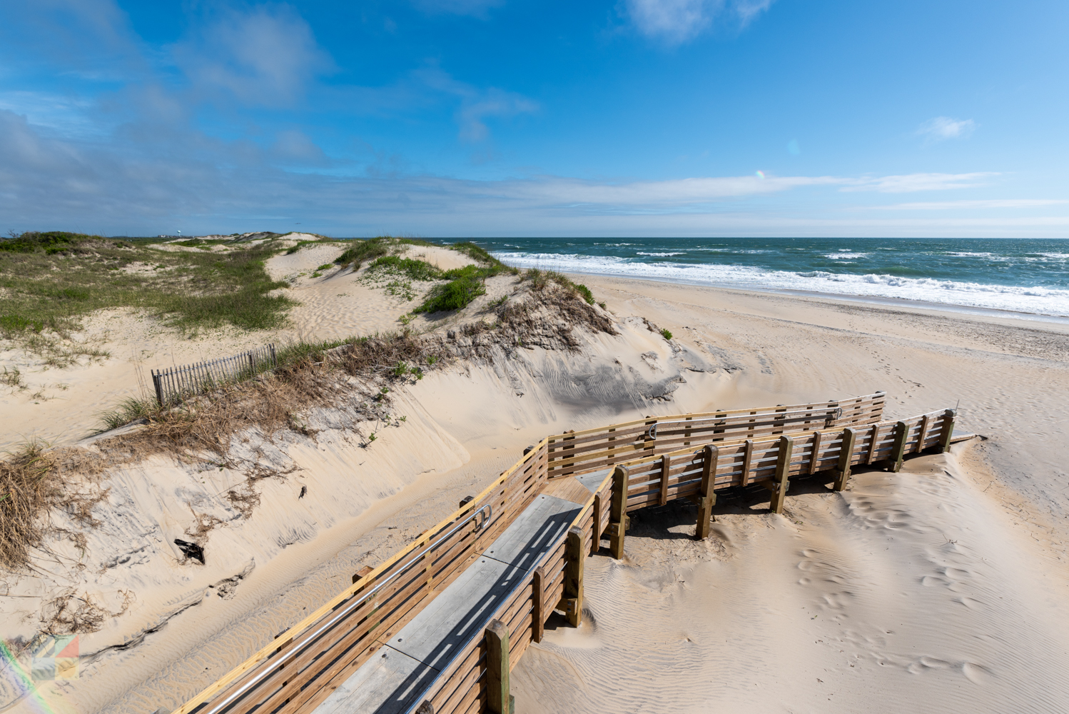
Coquina Beach was named after the tiny Coquina seashell, which flourishes on the Outer Banks. Beachgoers often spot their shells in the sandy shell piles that wash up on the beaches, and can occasionally spot live coquinas in the dense sandy patches just under the ocean wash. Coquinas come in a variety of stunning colors and patterns from brown and white horizontal stripes, to buttery yellows and oranges, and even vibrant violets and blues, making each little shell just a bit different. Lucky vacationers on uncrowded beaches in the warm summer months may spot clusters of hundreds of coquinas in the ocean wash, frantically inching towards the surface before burrowing back into the sand again, in intervals of 2-3 minutes. This phenomenon is what reportedly gave Coquina Beach its name, and it remains a well-loved sight by beachcombers and fishermen alike.
This stretch of beach essentially goes all the way to Oregon Inlet, which is seasonally open to both vehicles and pedestrians, depending on threatened bird nesting seasons, and provides some spectacular fishing conditions. Literally located directly under the Bonner Bridge, and offering a good half mile of inlet facing beaches, it's not unusual to spot dozens of vehicles lined up for spectacular shoreline fishing.
Because Oregon Inlet is essentially a gateway for large species passing through the ocean or Pamlico Sound, a number of fantastic game and sport fish can be landed here, including drum, stripers, croaker, bluefish, spots, and even cobias. In addition, the soundside portions of Oregon Inlet make for great wading waters for little ones, and also lead out to a series of fantastic but unmarked kayak or small skiff trails through the marshes. Just be sure not to wander too deep into the inlet's water. The section of inlet in between Bodie and Hatteras Island may at times look placid and clear, but underneath is a deep running current which can outmatch a swimmer of any level. It should also be noted that these beaches are generally open to visitors in the off-season, usually from August until March, well after the breeding seasons have ended.
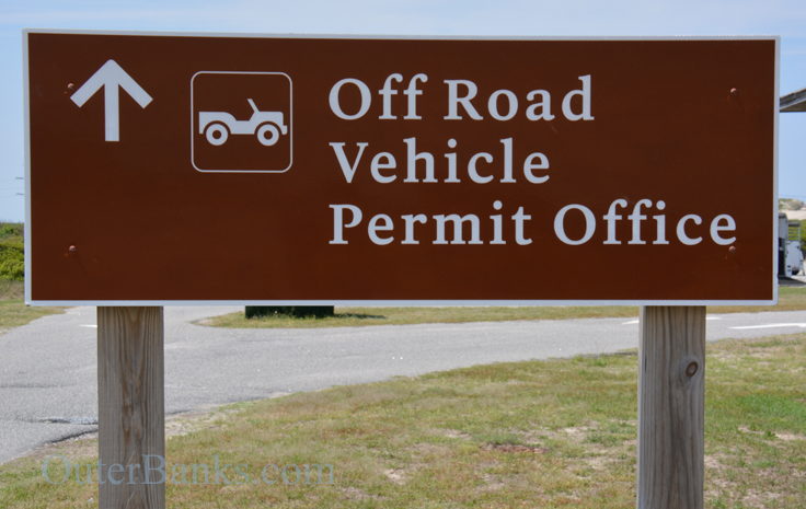
Bodie Island, and the beaches that lie south of Whalebone Junction, marks the beginning of the Cape Hatteras National Seashore (NPS), and as such, visitors who want to explore the beaches via a 4WD vehicle will need to obtain a NPS beach driving permit. In order to do so, a weekly or annual fee is required, and the applicant will also have to fill out appropriate forms and watch a 10 minute video on beach driving. The permit can be obtained at several locales throughout the Outer Banks, including a station adjacent to the Cape Hatteras Lighthouse, and one seasonally operated at Oregon Inlet, next to the beach ramp and camping area.
As for accommodations, restaurants, and resort attractions, Bodie Island doesn't have as much to offer as its central Outer Banks neighbors, but area lovers tend to get by just fine.
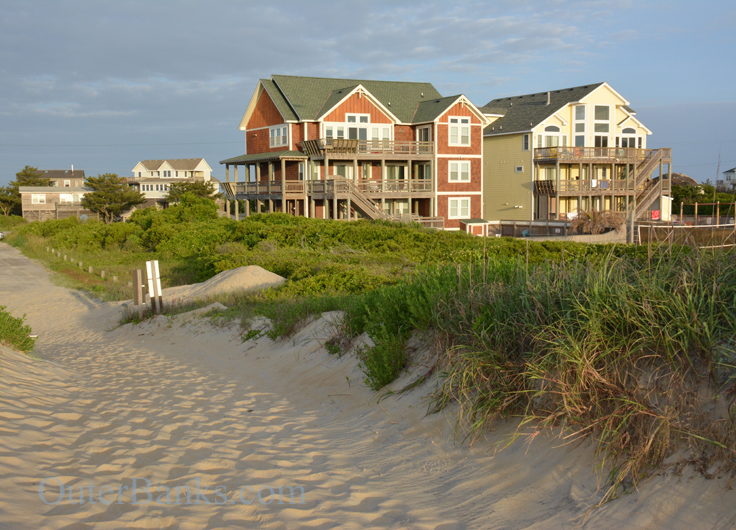
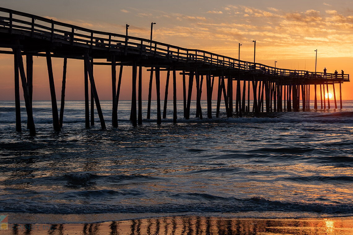
The region is home to a long stretch of rental homes that are clustered along the beaches of South Nags Head by the oceanfront. This area is adored by long-time vacationers for its seclusion and feel of being world's away, but still close to the big name attractions of the central Outer Banks. There are no hotels or motels in this area, and no restaurants or convenience stores either, but there is a fishing pier - the aptly named Ocean Pier - which is located in the heart of South Nags Head. At this small spot, visitors can find virtually anything they need in a vacation destination, from cold drinks and quick snacks, tackle and fishing gear, souvenirs and ice, and even a cool, quiet drink on the Ocean Pier's new oceanfront deck. This is the only main business in South Nags Head, but many vacationers find that this suits them just fine, as they can spend vacation days simply relaxing on the beach or on the spacious decks of their vacation rental homes.
From NC Highway 12, these rental homes seem far away, past acres of marshes and sandy brush, but one local Bodie Island accommodation is clearly visible to all travelers passing through, the National Park Service Oregon Inlet Campground. Technically located in South Nags Head, this campground is in the heart of Bodie Island and offers 120 sites for campers, RVs, and tents. Open from April until November, the sites are located just a quick walk away from the beach on the oceanside, tucked along tall sea oats and smaller sand dunes.
Facilities are generally limited, but the campground does feature public restrooms and seasonally open showers, park grills, as well as NPS staff on hand to answer questions. Campers who treasure a stay in the middle of nowhere, (with some pretty fantastic Bodie Island lighthouse views to boot), will be well served to check out the Oregon Inlet NPS campground. Reservations are not accepted, but information and local NPS guidelines can be found on the park's website.
For most vacationers, Bodie Island is simply an area to "pass through" en route to Hatteras Island, or an hour or two afternoon trip to check out the Bodie Island lighthouse, the closest Outer Banks lighthouse for the major vacation towns of Nags Head, Kill Devil Hills and Kitty Hawk.
But underneath the miles of seemingly desolate highway lies fantastic beaches, secluded rental homes, a truly wild campground, and one of the island's busiest marinas for charter boats and local tours. This is all in addition to the fantastic birding, from both the roadside bird stands and Bodie Island's Nature Trails, and the everyday wildlife sightings, with dozens of egrets, small rabbits and white-tailed deer clearly visible from NC Highway 12 during virtually any season.
On your next Outer Banks vacation, why not slow down and spend an afternoon exploring the regions of Bodie Island. With miles of waterfront, pristine and rarely visited beaches, and a couple of big name attractions along the way, this is one section of the Outer Banks that is certainly worth remembering.
Frequently Asked Questions
Where is Bodie Island?
Bodie Island is the stretch of shoreline that is located in between the southern borders of Nags Head at Whalebone Junction, and Oregon Inlet.
Is Bodie Island an Island?
Bodie Island is not an island – or at least, it is not an island anymore. At one point, it was its own island, but when the Roanoke Inlet that separated it from the northern Outer Banks closed in 1811, it became part of a larger peninsula that includes the central Outer Banks. Bodie Island is bordered to the south by water, however, courtesy of Oregon Inlet.
When did Bodie Island stop being an Island?
Bodie Island stopped being an island in 1811, when the Roanoke Inlet shoaled and closed, and the former island connected to Nags Head and the rest of the northern Outer Banks.
Where is the Bodie Island lighthouse?
The Bodie Island Lighthouse is located approximately 7 miles south of Whalebone Junction and the town of Nags Head, and about three miles north of Oregon Inlet and the Bonner Bridge.
How do you pronounce Bodie Island?
Bodie Island is pronounced like the word “Body,” although it’s a common mispronunciation to say the word with a long southern “OH” – as in “BOH-die.”
Where are the beach accesses on Bodie Island?
There are two ORV ramps for 4WD vehicles on Bodie Island, as well as several beach access points that are open to the public. Popular beach access areas include the Coquina Beach Day Use Area, which has restrooms and seasonal showers, and the Oregon Inlet Campground. In addition, there are a number of vacation rental homes in the South Nags Head area of Bodie Island which are close to community or town beach walkways.
Who manages or owns Bodie Island?
Bodie Island is part of the Cape Hatteras National Seashore, and is managed by the National Park Service.
Can you drive on the beaches of Bodie Island?
Bodie Island is in the northernmost region of the Cape Hatteras National Seashore, and as such, the area has two ramps for 4WD vehicles – Ramp 2 and Ramp 4. Beach driving is permitted along the shoreline, (although the southern section of Bodie Island is seasonally open from mid-September to mid-March), and a beach driving permit from the National Park Service is required.
Where are the Bodie Island off road vehicle ramps?
The two Bodie Island ORV ramps are located next to the Coquina Beach Day use area, and the Oregon Inlet Campground, respectively.
Can you fish on the Bodie Island beaches?
Surf fishing is allowed all along the Bodie Island beaches. A saltwater fishing permit is required, and sections of the shoreline next to Oregon Inlet may be seasonally closed for bird nesting in the summer months.
Are there shells on Bodie Island?
Because of its limited development, relative isolation, and proximity to Oregon Inlet, Bodie Island can be a good destination for beachcombers. The Coquina Beach Day Use Area, (which is named after the small and colorful coquina shell), is a good place to start, as is the shoreline that borders Oregon Inlet, and the nearby dredge spoil islands that are accessible by boat or kayak.
What are the Bodie Island attractions?
Bodie Island is primarily known for its lighthouse, the black and white striped Bodie Island Lighthouse which was built in 1872. The area is also home to one of the largest fishing centers on the Outer Banks, the Oregon Inlet Fishing Center, as well as beaches that are within the Cape Hatteras National Seashore. Additional area points of interest include a fishing pier in South Nags Head, and the National Park Service-managed Oregon Inlet Campground.
Are there shops and restaurants on Bodie Island?
The South Nags Head area just south of Whalebone Junction has a fishing pier with a grill and tackle / convenience store, and the Oregon Inlet Fishing Center has a convenience store as well. Otherwise, there are no shops or restaurants on Bodie Island.
How do you get to Bodie Island?
Visitors from the south can reach Bodie Island by travelling over the Bonner Bridge. From the north, visitors can head to NC Highway 12 and Whalebone Junction, which is the unofficial start of Bodie Island.
How long is Bodie Island?
Bodie Island is a little less than 10 miles long.
Where did the name Bodie Island come from?
The accepted origin of the name Bodie Island is that it stemmed from an original landowner and settler of the area, who was named “Body” or “Boddy.” A more colorful legend is that it was named after the many bodies that washed ashore from centuries of shipwrecks in the Outer Banks’ Graveyard of the Atlantic.
Where can you stay on Bodie Island?
Bodie is home to a National Park Service campground, the Oregon Inlet Campground, which is seasonally open to RV and tent campers. There are also a number of vacation rentals in the northern area of Bodie Island, in the South Nags Head region.
Can you camp on Bodie Island?
Camping is permitted at the Oregon Inlet Campground, which is situated in the southern section of Bodie Island. The campground is seasonally open in the late spring, summer, and early fall months, and reservations can be made online through the National Park Service website.
What is there to do on Bodie Island?
Because Bodie Island is close to Oregon Inlet and is known for its exceptional beaches, the area is a popular spot for boating, kayaking, shelling, fishing, birdwatching, and just enjoying the empty shoreline. In addition, Bodie Island is the site of the historic Bodie Island Lighthouse, and the Oregon Inlet Fishing Center, which is a popular launching point for inshore and offshore charter fishing trips.
Where can you kayak on Bodie Island?
A boat ramp for kayaks and other vessels can be found next to the Oregon Inlet Fishing Center, on the soundside of Bodie Island. Paddlers can explore the soundside inlet waters and marshy channels, but are urged to pay attention to seasonal beach closures before landing on area dredge spoil islands or the beaches bordering the inlet.
Where can you go birdwatching on Bodie Island?
Bodie Island is a popular birdwatching destination, and the area has multiple observation points for visitors. Several viewing platforms can be found on the soundside of NC Highway 12, and the Bodie Island Lighthouse has an adjacent nature trail that leads to maritime forest and soundfront terrain.
-
Avon Farmers Market
July 28th, 2026 9:00 AM - 1:00 PM -
Lighthouse 5K Series
July 29th, 2026 8:00 AM - 9:00 AM -
Beach Apparatus Drill
July 30th, 2026 1:30 PM - 2:30 PM
Henry's Restaurant offers down home, simple food done Outer Banks style. Henry's Restaurant has been serving the Outer Banks of North Carolina since the summer of 1989. They are pleased to be considered one of the most popular restaurants in Dare...

The Bodie Island Lighthouse, (pronounced "Body") is located just south of the town of Nags Head and Whalebone Junction, where Highway 158, Highway 64, and NC Highway 12 intersect. Visitors travelling towards Hatteras Island can't help but notice the...

Black Pelican oceanfront restaurant is one of the Outer Banks’ premier restaurants serving lunch and dinner daily. Black Pelican is where you can enjoy fresh seafood, steaks, vegetarian dishes, sandwiches and some of the barrier island’s...
The Outer Banks is famous for its beautiful beaches and stunning views. One of the best ways to experience the beauty of the Outer Banks is to wake up early and watch a stunning sunrise over the Atlantic ocean. With miles of pristine coastline...

We are the only Authorized Shipping Center on the OBX for FedEx, UPS and DHL. Come to OBX Shipping Center for all your shipping and office needs. We offer Notary services, copies, faxing, laminating, among other office services. You do the...

The Ocracoke Harbor is easily the busiest quarter mile stretch of Ocracoke Island. Consisting of a small, lagoon-like section of saltwater, and lined by a semi-circle of docks, restaurants, shops, marinas and motels, visitors will find that any and...
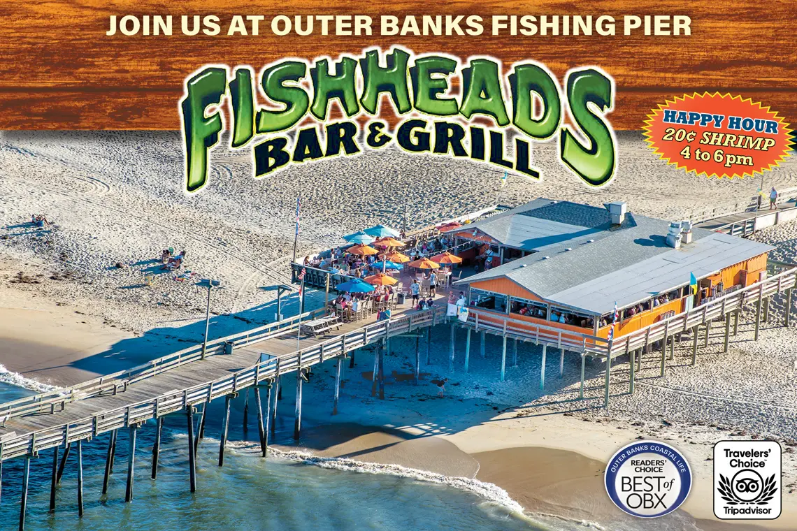
Rustic waterfront pub at a fishing pier with a large deck for seafood eats, draft beer & live music. Fish Heads Bar and Grill is THE tiki bar of the Outer Banks. Located at Mile Post 18.5 in Nags Head, we offer a view that is second to none...
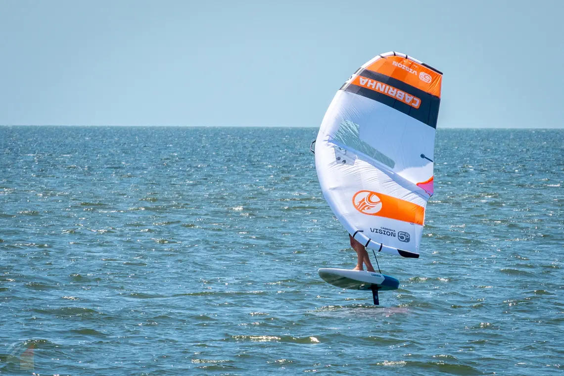
Canadian Hole may be an unfamiliar term to the typical, laid-back Hatteras Islander vacationer, but to windsurfers around the world, the phrase invokes thoughts of an exact, postcard-perfect locale on the Outer Banks, where windsurfing and water...

No trip to the Outer Banks is complete without cruising through Brew Thru, the Outer Banks’ original drive thru convenience store. Whether you’re looking for a refreshing cold beverage of Coke, Pepsi and other soft drinks on the go...
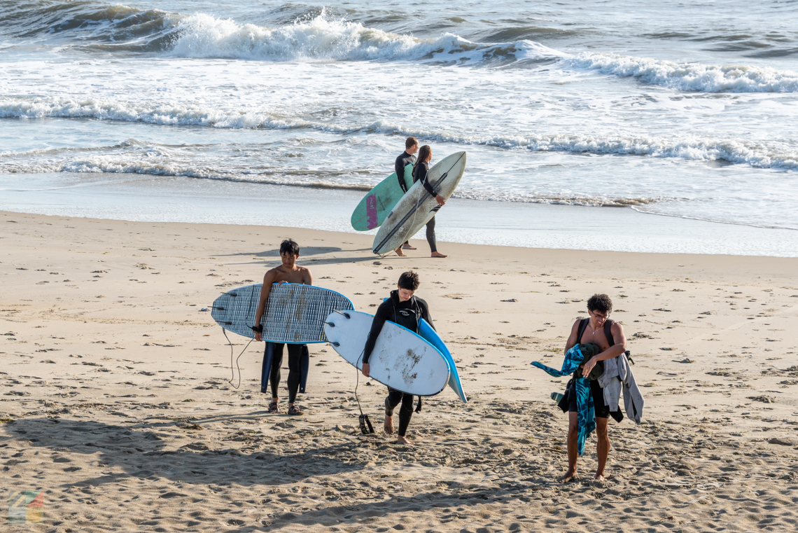
Forget Hawaii and California - on the East Coast, the best place for surf is on the Outer Banks, and this region is renowned as one of the best surfing destinations from New York to Florida. Surfers from all over the country and the world flock to...

Since 1968, our family owned and operated company has offered families just like yours a wide selection of Outer Banks vacation rentals in beach communities and towns of Duck, Southern Shores, Kitty Hawk, Kill Devil Hills, Nags Head and South Nags...
On the Outer Banks, it's easy to throw in a little education in with a vacation filled with fun, adventures, and new explorations.
