
Every visitor who comes to Hatteras or Ocracoke Islands from the north will encounter Oregon Inlet. Separating the small barrier islands of the southern Outer Banks from Bodie Island and the northern Outer Banks communities of Nags Head, Kill Devil Hills, Kitty Hawk and Manteo, Oregon Inlet is arguably the most visited and traversed inlet on the islands.
Always shifting and seemingly always a focal point of local history or controversy, Oregon Inlet is nonetheless a breathtaking area of open water that connects the Atlantic Ocean and the Pamlico Sound, providing an easy route for charter fishermen, commercial fishermen, and day trippers to get out and explore the waters. With lovely ocean or soundside beaches located on either side, and a historic US Coast Guard station, (formerly a Lifesaving station), perched at the edge of the inlet's shores, a visit to Oregon Inlet typically includes some enjoyable beach time, good fishing, and simply incredible views.
History of Oregon Inlet
Like most all of the past and present inlets along the Outer Banks, Oregon Inlet was created when a violent hurricane passed through the area in 1846, creating a wide watery gash in between Bodie Island and Pea Island. During the storm, a ship that was caught in the Pamlico Sound for the action, the Oregon, witnessed the sudden formation of the new inlet, and after the storm had passed and the crew collected their bearings, they headed to the mainland to spread the word of the new wide inlet that now separated Hatteras Island from the rest of the Outer Banks. As a result of their initial accounts, the inlet was named after the ship that spread the news, and has been called Oregon Inlet ever since.

Less than 40 years after its formation, the US Lifesaving Service, the predecessor to the modern day US Coast Guard, was undergoing a lengthy process of erecting lifesaving stations all along the Outer Banks, and decided to build a small station along the borders of Oregon Inlet. The Coast Guard had received funds to build 29 stations along the East Coast, and this station, they reasoned, would protect passing mariners both along the oceanfront and along the soundside. With easy access to both bodies of water, enabling rescue boats to access the ocean quickly and easily, an inlet-bordering station seemed to be a smart move.

The station was built in 1883, and unfortunately, just five years later, had to be relocated. One of the defining characteristics of an inlet is its always variable geography, and as the inlet moved, the original station came closer and closer to falling into the water.

The station was moved in 1888, but suffered another bout of bad luck when a hurricane passed through and demolished the station to the ground less than a decade later. Another station was quickly erected further west, and this 1897 station had a much longer and productive life. The Oregon Inlet station enjoyed decades of service with the US Coast Guard before it was decommissioned with the arrival of more modern stations, and, eventually, abandoned in 1988 with the Coast Guard vacating the premises entirely and turning the station and the 10 acres that surrounded it over to Dare County.

With the station no longer of any use to either the Coast Guard or the county, it simply sat at the edge of Oregon Inlet, exposed to the elements, drifting sand, and even passing vandals. For the next 20 years, visitors who crossed the Herbert C. Bonner Bridge en route to Hatteras Island would barely notice the deteriorating structure that was virtually buried by piles of drifting sand.
This all changed in 2000 and 2001, when Dare County gave the property to the state, who in turn assigned it to the North Carolina Aquariums, and a plan began to bring life back to the historical 11,361 square foot wood station. After years of planning, work began in 2008 to raise the station onto pilings, renovate both the exterior and interior, and return it to its formal glory.
The careful renovations were completed by 2011, and today, visitors to the beaches of Oregon Inlet would never guess that the historical structure was ever abandoned and approaching total disrepair.
Oregon Inlet is also famous for igniting the NC Ferry System that serves the coastal islands of the Outer Banks. When the inlet was formed, after all, Hatteras Island was already home to healthy population of tradesmen, lifesaving station employees, and local villagers, and just a decade before Oregon Inlet came to fruition, Hatteras Inlet had also opened up at the southern end of the island, just south of Hatteras Village. This meant that the population was essentially stranded, and the only way to get on or off the island was by boat.
During the 1850s and beyond, this wasn't necessarily a concern since with no roads or vehicles, a boat was the only logical method of transport anyways. However, as the outside world progressed, and vehicles became more common, it became clear that Hatteras Islanders and the handful of people that wanted to visit the southern Outer Banks needed a way to get across Oregon Inlet.
As a result, an enterprising local, Captain Toby Tillet, began to make ferry runs across Oregon Inlet with a tug boat and barge that could carry a small number of vehicles across the water. These initial ferry runs began in the 1920s, and by 1934, the North Carolina Highway Commission had taken notice and decided to subsidize these ferry trips, keeping tolls affordable for residents and visitors alike. By 1950, Tillet's entire ferry business was sold to the state, and soon other state-sponsored ferry operations began to pop up along the Outer Banks, most notably across the Croatan Sound, which became the first official NC Ferry route.
Today, the NC ferries transport over 1.1 million vehicles across North Carolina's coastline and bodies of water every year, but he NCDOT's Ferry Department has humble roots, beginning less than a century ago with the arrival of Tillet's tug boat across Oregon Inlet.
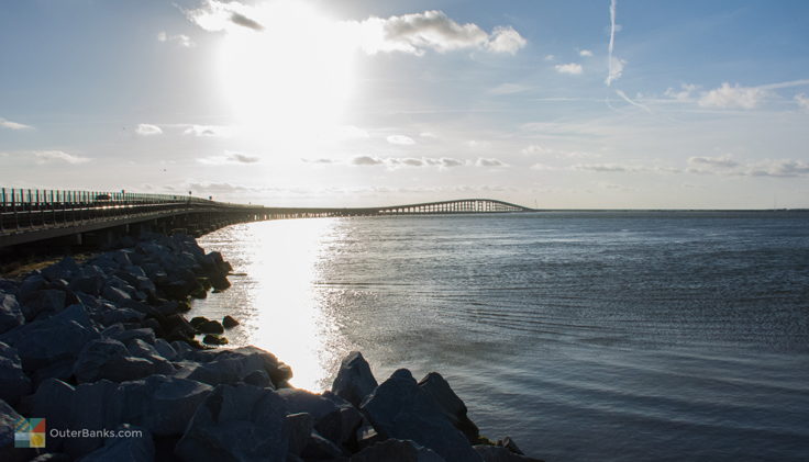
By the late 1950s, the ferry traffic to and from Hatteras Island had increased to the point that a bridge was necessary, and the Herbert C. Bonner Bridge officially opened to vehicles in 1962, spanning across Oregon Inlet, and providing commuters and day trippers with an easy way on and off the island.
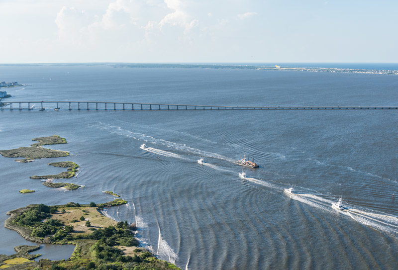
In recent years, Oregon Inlet has become a point of mild controversy. In synch with the nature of inlets which are continuously expanding or retracting, the inlet has begun to close up and efforts have been made by the state and federal governments to commence regular dredging to keep the inlet wide open for commercial and charter fishermen. (Dredging is essentially a method of digging up the shallow sand on the ocean floor and tossing the sand particles into the water, where they are carried away into the ocean or the Pamlico Sound.) For some folks, the costly endeavor may simply be delaying the inevitable closing of the inlet, while other parties believe the efforts a necessary step to keep the local fishing industry intact. With no definitive resolutions in sight, annual dredging efforts are still underway, and off-season or even summer season visitors passing over the inlet on the Bonner Bridge may spot these huge dredging ships, spouting tons of sand and water into the air above.

The Geography of Oregon Inlet
Oregon Inlet is one of the larger Outer Banks inlets at 2.5 miles wide, a distance which changes regularly with shifting sand bars or incoming or outgoing tides. The inlet is bordered on the southern side by Pea Island, which has a protective rock barrier to both limit erosion by the Oregon Inlet Coast Guard station, and to serve as a sort of bulk head for the inlet to remain deep and traversable. On the southern side of the inlet lies a wide, waterfront beach, bordered by a series of saltwater canals that snake through an expansive one half mile or so soundside marsh.
Also on the soundside, visitors will find a number of small sandbars and islands, a handful of which even have deer stands or small rustic cabins that are privately owned and can only be accessed by a boat.
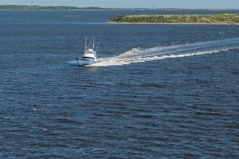
Located close to the Gulf Stream for exceptional offshore fishing, Oregon Inlet is a popular waterway for commercial and charter fishermen alike, who make daily runs under the Bonner Bridge to the open ocean waters.
Things to do along Oregon Inlet
Like all Outer Banks inlets, the most popular activity along the perimeter of Oregon Inlet is fishing, and deep sea fishermen and surf fishermen alike will find plenty to love about this area.
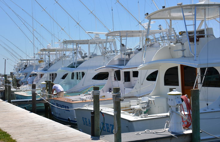
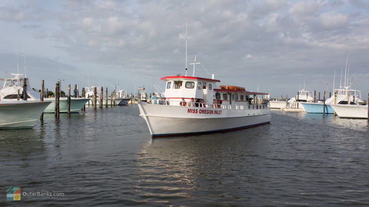
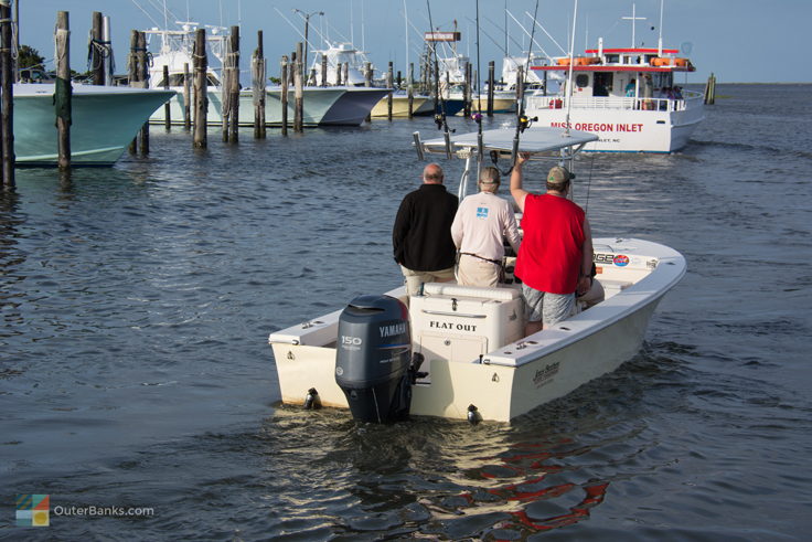
Many of the charter boat businesses on the Outer Banks pass through Oregon Inlet to get to the Gulf Stream, particularly all of the businesses that cater to the central Outer Banks regions. A number of boats are located along the Wanchese boat docks, which are located just a 15 minute ride away, or even right next to the inlet itself at Oregon Inlet Marina, which is literally located on the northern banks of the inlet's borders. From here, it takes just moments to pull out of the boat slip and head towards the open water, making fishing trips from this marina one of the quickest runs out of the sound and into the open ocean waters.
Because of this, visitors who travel over the Bonner Bridge in the early morning hours or in the late afternoon will notice a distinctive line of charter boats parading to or from the ocean, across Oregon Inlet. Visitors who are staying in the central and northern Outer Banks areas who are interested in a half day or full day of charter fishing would be well advised to scope out the charter boats that leave from Oregon Inlet. Located close to the Gulf Stream, and providing an easy trip from the harbor to the inlet, these businesses are generally the most convenient for northern Outer Banks vacationers.
In addition, the Oregon Inlet Marina is also home to a number of local tour boats that take visitors out on scenic tours along the water. Whether vacationers embark on a wildlife tour, a dolphin tour, or simply a little sunset spin around the Pamlico Sound, Oregon Inlet provides an ideal gateway to a number of on-the-water tours and fishing adventures.
Vacationers who bring their own boat along can also be spotted anchored or trolling around the open Oregon Inlet waters, as the pilings from the Bonner Bridge can attract a lot of tasty game species, including sheapshead or even Amberjack, both of which love feeding and congregating near structures in deep waters.
For visitors who love to fish but don't necessarily need a boat ride to do so, there are also plenty of locations along the inlet to cast a line.
One of the most popular and unique spots along Oregon Inlet to go fishing is the Bonner Bridge itself. The southern end features a small walkway which is protected from vehicular traffic, but allows anglers to drop a line deep into the inlet's waters. In the summertime, it's not unusual to see several dozen anglers congregated next to the bridge, hoping for a big catch.
Also on the southern end of Oregon Inlet, anglers flock to the small soundside beach as well as the bulk headed inlet and ocean facing beaches for some fantastic surf fishing. Directly adjacent to the southern border of Oregon Inlet lies a large public parking area, perfect for anglers who want to enjoy a full day or evening of waterfront fishing. Seldom full and with plenty of elbow room even in the prime summer season, this area is perfect for surf fishermen who love a great view, as well as an easy stroll from the car directly to the water.
The northern side of Oregon Inlet also attracts surf fishermen as well, as this area features a wide beach that borders the inlet from the ocean to the soundside. Unless an angler is a good hiker, a 4WD vehicle is all but required to access the area and bring all the required fishing gear along. An entry ramp is located on the northern side of the Bonner Bridge, bordering the National Park Service station and Oregon Inlet campground. Once on the beach, many anglers will enjoy front-row access to the big game fish that frequent the inlet waters, including bluefish, mackerels, spots, croakers, mullets, cobias, and even the occasional shark.
A beach driving permit is required to drive on the beaches along Oregon Inlet, and can be purchased from the National Park Service station that borders the campground and access ramp. Also, visitors are advised to only access the beach via a 4WD vehicle. While the inlet bordering beaches are flat and generally consist of hard-packed sand, the ocean paths that lead out to the beach are soft and can only be traversed with a vehicle that has 4WD. Also, make sure you slack down your tires to 15-20 psi to further protect your vehicle from getting stuck in the soft sand.
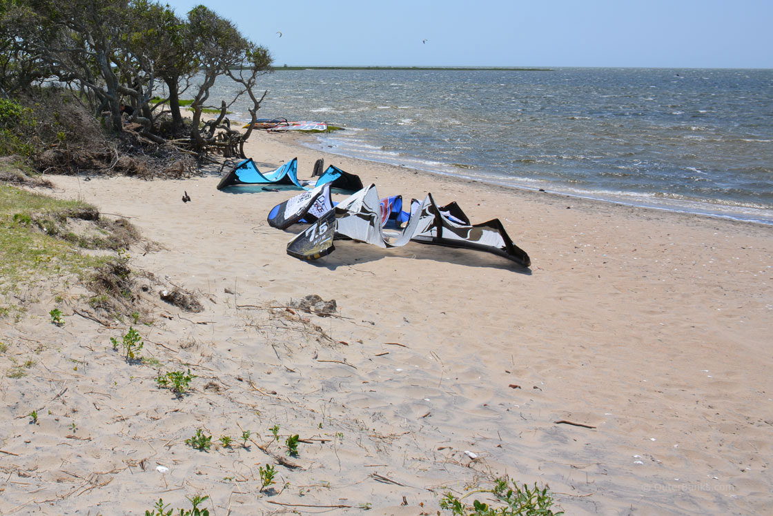
While fishing is clearly one of the most popular Oregon Inlet activities, it certainly isn't the only way to enjoy the area. In recent years, kayakers and birders have discovered the northern soundside borders of Oregon Inlet for its exceptional maze of canals that wind through the grassy marshlands. Here, birders can spot dozens of white egrets, pelicans, seasonal white swans and great blue herons, all of which carve out temporary homes along the bait-fish rich marshy sound waters.
Kayakers will be challenged navigating through the small canals and finding their way in and out of the sound, and birders will find they have incredible up-close-and-personal views of some of the Outer Banks' most famous local species, all from the comfort of a small boat, or simply on foot with a pair of high waders. Birders should also consider a trip to the southern shoreline of the inlet, as the small sandbars that lie just offshore are popular congregation locales for dozens of cormorants and pelicans, especially in the off-season and winter months.
Sightseers, photographers, and history buffs will also appreciate a trip to Oregon Inlet for the incredible views and unique Outer Banks landscapes.
While the historic US Coast Guard station isn't currently open to the public, visitors can still pull into the public parking area and walk the perimeter of the building admiring the intricate handiwork that went into restoring the station to its former glory.
Also on the northern side of the inlet, sunset lovers should check out the small soundside beach located just at the end of the Herbert C. Bonner Bridge. When the sun sets, this parcel of water turns multiple shades of orange, pink and purple, interrupted only by the occasional sandbar peeking out above the inlet waters.
On the northern side, the beaches are an incredible sight as visitors who drive out to the soundside of the inlet will find themselves almost directly under the Bonner Bridge. A strange but exhilarating experience, vacationers can literally watch the traffic pass by as they enjoy their own secluded patch of shoreline. This vantage point is also ideal for photos of the inlet itself, the Bonner Bridge spanning across the inlet, and the small, tucked away Coast Guard station that stands watch over the watery area.
Tips and Tricks for Visiting Oregon Inlet
- The 4WD accessible northern beaches of Oregon Inlet are seasonally open, and generally close from mid-spring until early fall for threatened species breeding seasons. To see if the beach is currently open to vehicles or pedestrians, visit the National Park Service's website. Remember that this closure extends not just to vehicles, but to kayaks and boats too, and all vessels are encouraged to pay attention to any shoreline closure signs when making an expedition around the inlet.
- While the soundside borders of Oregon Inlet are ideal for kayakers or explorers, everyone is advised to steer clear from the rushing waters of the inlet itself. This section of the inlet produces fast currents and deep waters, which flow well out into the sound and the ocean, and should only be traversed by a motorized boat.
- While the views of Oregon Inlet from the top of the Bonner Bridge are incredible to be sure, drivers are reminded to maintain the 55 mph speed limit, and not stop or slow down on the top of the bridge. There is limited sight distance on either side of the top of the bridge, and a slowed or stopped vehicle can cause a major traffic hazard.
- Searching for a fantastic photo opt, or a much needed break from the road? Simply pull over to the public parking area on the northern side of the inlet and stretch your legs. From here, visitors can stroll around the original late 1800s Coast Guard station, take a walk to the ocean or soundside beaches, or hop up to the small walkway that borders the Bonner Bridge. Any section of this area is worthy of exploring, and can provide some fantastic photos to boot.
- Kayakers who want a closer view of the inlet but want an out-of-the-way route can launch from the New Inlet boat launch located approximately 3-4 miles away from the Bonner Bridge on Pea Island. This area was once a legitimate inlet until it was filled in, and the area offers incredible access to the Pamlico Sound and a moderate paddle towards the inlet for both kayaks and small skiffs.
At a little over 150 years old, it's amazing that Oregon Inlet has both a deep and influential history, as well as a devout following among recreational and commercial fishermen alike. In addition, the beaches bordering the inlet as well as the small metal walkway that extends above the water, are incredible fishing grounds as well as home to some of the most unique and incredible views on the Outer Banks.
On your next vacation, whether you're looking for a truly out-of-the-way place to enjoy the beach, or just need an amazingly scenic break from the road, take a stop by Oregon Inlet. A small collection of history, active marinas, and amazing views, Oregon Inlet is an area of the Outer Banks that virtually every visitor can easily take in and admire.
Frequently Asked Questions
Where is Oregon Inlet?
Oregon Inlet is the northernmost inlet on the Outer Banks. It is located just south of Nags Head, and separates Hatteras Island from Bodie Island and the rest of the central Outer Banks.
When was Oregon Inlet created?
Oregon Inlet was created in 1846, after a hurricane passed through the Outer Banks and cut a new channel in between present-day Hatteras Island and Bodie Island.
Where did the name Oregon Inlet come from?
The legend is that the inlet is named after a sailing vessel from Edenton that first navigated through the newly created channel during an 1846 storm. While this explanation isn’t for certain, the inlet was decidedly not named after the state of Oregon, which wasn’t established until 13 years after Oregon Inlet formed.
How old is Oregon Inlet?
Oregon Inlet is more than 160 years old.
How did Oregon Inlet form?
Oregon Inlet formed during a hurricane in the year 1846, which created a new channel of ocean and sound water in between then-Pea Island and Bodie Island.
How wide is Oregon Inlet?
Oregon Inlet is 2.5 miles wide, which makes it one of the widest inlets on the Outer Banks.
How long is Oregon Inlet?
Oregon Inlet is 12,866 ft. long from Bodie Island to the edge of Hatteras Island.
How do you get across Oregon Inlet?
Visitors travel across Oregon Inlet via the Herbert C Bonner Bridge, or simply the “Bonner Bridge,” which connects Hatteras Island to the rest of the central and northern Outer Banks.
Is there a ferry at Oregon Inlet?
There is no ferry at Oregon Inlet, but there used to be ferry service for visitors and residents heading to Hatteras Island prior to 1963, before the Bonner Bridge was established.
What are the houses in the middle of Oregon Inlet?
There are several small and privately owned islands in the middle of Oregon Inlet, where a handful of houses can be found. At least one of these is a former hunt club dating back more than a century, while several others are more modern residences that were built within the past 20-30 years. The homes and islands are individually owned, and have no electricity except for generator power. They are also only accessible by boat.
What are the islands in the middle of Oregon Inlet?
Many of the islands in Oregon Inlet are known as “dredge spoil” islands, and are sandbars from discarded dredge sand and material that built up over the years. Today, some of the oldest islands can have trees, high sand dunes, vegetation, and native critters including birds, reptiles, and mammals such as foxes.
When was the Bonner Bridge built?
The original Bonner Bridge was built in 1963. The new Bonner Bridge broke ground in March of 2016.
When will the new Bonner Bridge be complete?
The new Bonner Bridge is scheduled to be completed by the fall of 2018.
Is the Bonner Bridge safe?
The Bonner Bridge is safe to drive on, thanks to numerous repairs and inspections over the years, however the replacement bridge being built is certainly needed. The original Bonner Bridge had a 30-year lifespan that it surpassed in 1993.
How long will the new Bonner Bridge last?
The new Bonner Bridge is slated to have a lifespan of 100 years.
How long is the Bonner Bridge?
The original Bonner Bridge is 2.7 miles long. The new Bonner Bridge is slightly longer at 2.8 miles long, not including the on ramps.
How do you access Oregon Inlet?
Visitors can access Oregon Inlet with a kayak or boat via the launching ramps next to the Oregon Inlet Fishing Center on Bodie Island. Beach-goers can head to the inlet via the parking area on the southern side of the Bonner Bridge, or via the beach access / ORV ramps near the Oregon Inlet Campground.
What is the old building at the southern end of Oregon Inlet?
The historic structure at the southern end of Oregon Inlet is an original U.S. Life-Saving station, (and later Coast Guard station), that was built in 1898.
Where is the Oregon Inlet Fishing Charter?
The Oregon Inlet Fishing Center is located next to the northern terminus of the Bonner Bridge.
How do you reserve an Oregon Inlet fishing trip?
Visitors can reserve an inshore or offshore fishing trip by calling the Oregon Inlet Fishing center directly, or by contacting a local charter fishing business that operates out of the fishing center’s docks.
Is there gas and food at the Oregon Inlet Fishing Center?
The Oregon Inlet Fishing Center has gas available for mariners - (not for vehicles) - as well as an on-site convenience store for drinks, snacks, and fishing gear and supplies.
What can you catch when fishing in Oregon Inlet?
Oregon Inlet connects with the sound and ocean waters, and as such, it is a very popular spot for a wide array of inshore saltwater species. Popular catches include bluefish, flounder, drum, croaker, and fish that are attracted to structures, (like the Bonner Bridge pilings), such as sheapshead.
How do you fish in Oregon Inlet?
Visitors can access the Oregon Inlet waters via the two beaches on either side of the inlet, an inshore fishing charter, a privately owned boat or kayak, or by heading to the fishing deck on the southern end of the Bonner Bridge.
Can you fish from the Bonner Bridge?
Fishing is allowed from the southern end of the Bonner Bridge on the designated pedestrian walkway. When the new bridge is complete in 2018, the old structure will be torn down, except for a portion of the southern end, which will continue to be used for fishing.
Where are the beach accesses near Oregon Inlet?
Visitors can park at the southern end of Oregon Inlet next to the original Coast Guard Station to reach the beach on foot. On the northern end of the inlet, visitors can park at the Oregon Inlet Campground, or use ORV Ramp 4 to access the beaches bordering the inlet with a 4WD vehicle.
Can you kayak in Oregon Inlet?
Kayaking is allowed in Oregon Inlet, and a boat ramp / launching site is located next to the Oregon Inlet Fishing Center.
Can you swim in Oregon Inlet?
Visitors should not swim in Oregon Inlet as the currents that flow through the channel are deceptively swift.
Can you travel through Oregon Inlet?
Boats can travel through Oregon Inlet, as the inlet is continually dredged to prevent shoaling.
How often is Oregon Inlet dredged?
Oregon Inlet is continually dredged year-round to keep it open to recreational mariners and emergency vessels.
Is there a Lighthouse at Oregon Inlet?
The Bodie Island Lighthouse is located just a couple miles north of Oregon Inlet.
Can you take photos of Oregon Inlet from the Bonner Bridge?
Visitors are urged to maintain the 55 mph speed limit on the Bonner Bridge, and not slow down at the top to take photos, in order to ensure the safety of other vehicles travelling on the bridge.
Are there shells on the Oregon Inlet beaches?
Shelling can be very good by the Oregon Inlet beaches, and especially near the 4WD accessible beaches on the northern side of the inlet. Shelling is also good at the dredge spoil islands in the middle of the inlet, which can be reached by a boat or kayak.
Can you camp at Oregon Inlet?
A campground that is managed by the National Park Service is located just north of Oregon Inlet. The Oregon Inlet campground is open seasonally, and can accommodate tent and RV campers.
Can you get to the Gulf Stream from Oregon Inlet?
Oregon Inlet is the closest inlet to the Gulf Stream for many vacationers in the central Outer Banks. A number of offshore charter boats use Oregon Inlet to access the Gulf Stream on fishing trips.
Can you drive on the beaches next to Oregon Inlet?
Driving on the beaches at the northern end of Oregon Inlet is seasonally permitted, as the shoreline is part of the Cape Hatteras National Seashore. A beach driving permit from the National Park Service is required, and stretches of shoreline may be seasonally closed for bird nesting activity.
Do you need a permit to drive on the Oregon Inlet beaches?
A permit is required to drive on the beaches that border Oregon Inlet. A beach driving permit can be picked up at the local ranger station just north of the Bonner Bridge, or online at the National Park Service website.
-
Annual One-Design Regatta
July 25th, 2026 -
Surfing For Autism
July 23rd, 2026 - July 25th, 2026 -
Carolina Boat Builders Tournament
July 22nd, 2026 - July 26th, 2026

Serving our customers on the Outer Banks since 1994, Big Buck's ice Cream is dedicated serving you “The Best.” We offer a full line of super-premium ice cream products, smoothies, chocolates, and custom-made ice cream cakes! 2 locations...

It's easy to see why vacationers fall in love with Carova. Located almost literally off the Outer Banks map, while other towns along the barrier islands of North Carolina grew and developed over the decades and became popular East Coast tourism...

Stop by Nags Head's Ben Franklin at Mile Post 10 on the Bypass where you will find everything you need for the beach! From Clothing, T-shirts and Swimwear to Boards, Chairs, Umbrellas and Tackle. You'll find it all…and of course, we have the...
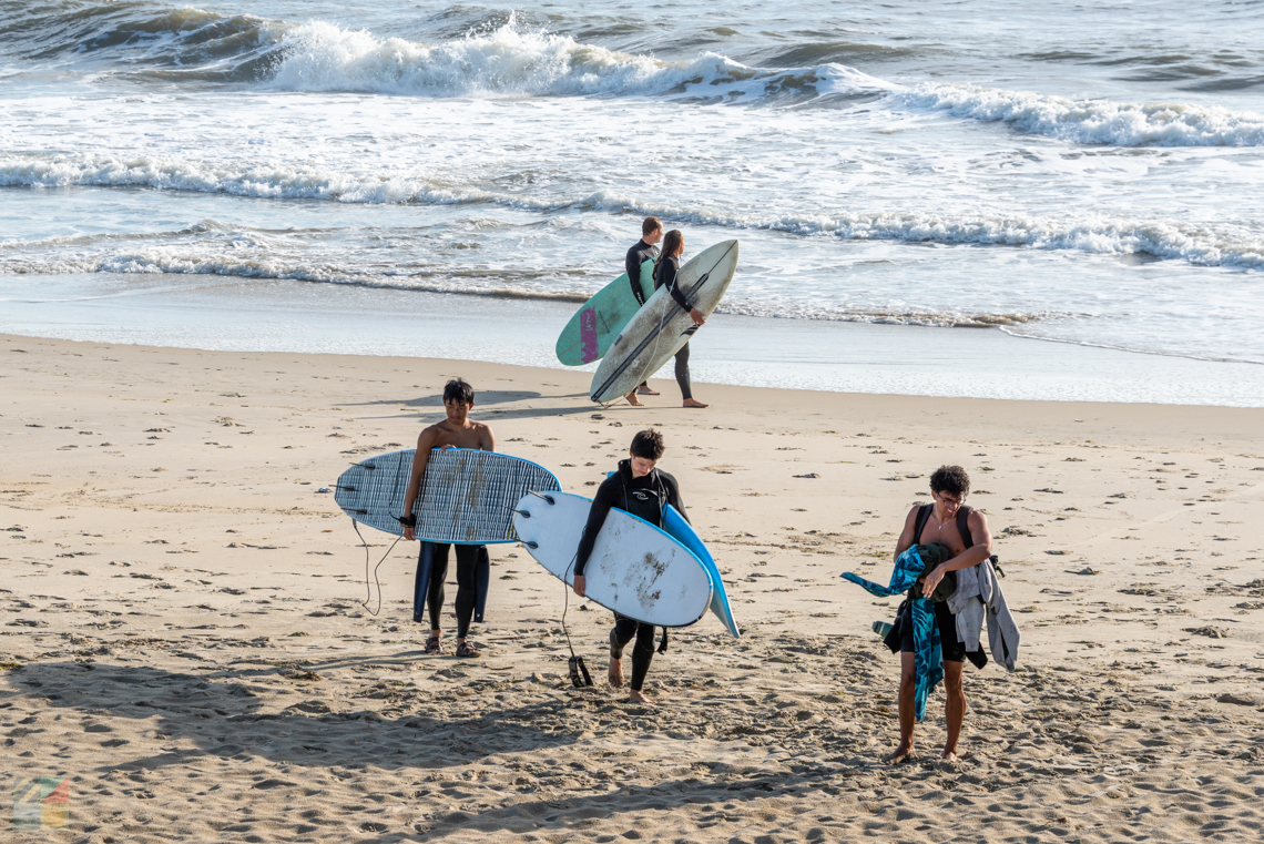
Forget Hawaii and California - on the East Coast, the best place for surf is on the Outer Banks, and this region is renowned as one of the best surfing destinations from New York to Florida. Surfers from all over the country and the world flock to...

Scientists run these dolphin tours as part of their research on these beloved aquatic animals, so you know this will be an interesting trip. Passengers will be able to see how researchers with the Outer Banks Center for Dolphin Research, a nonprofit...

The Outer Banks offers plenty of opportunities for a healthy, family fun vacation. Visitors can spread out over more than 100 miles of pristine shoreline. Local restaurants and eateries are providing abundant take-out and delivery...


Long before the summer vacationing families discovered the Outer Banks as a hot tourist destination, fishermen from across the country flocked to coastal North Carolina. With no roads to navigate, and no vacation homes to stay in, anglers would...

Enjoy Waterfront Dining at Basnight's Lone Cedar Café where we specialize in fresh and local Outer Banks seafood. If you’re craving the freshest fish, clams, crab, shrimp and oysters from local North Carolina waters, you’ll find...
Ask any crowd of visiting kiteboarders about Kite Point, and they'll readily give you exact directions to this unmarked but internationally renowned soundside beach. Located in between Avon and Buxton villages abutting the Pamlico Sound, Kite Point...

PokeBox offers fresh, quick, simple, healthy poke bowls in Nags Head. Choose your items and build your bowl. Tuna, salmon, chicken, steak, shrimp and tofu options available. Mix in your favorite veggies, sauces and toppings for the perfect poke...